Syed Shayan Real Estate Archive
Syed Shayan Real Estate Archive
From Real Estate History
Syed Shayan Real Estate Archive

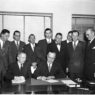
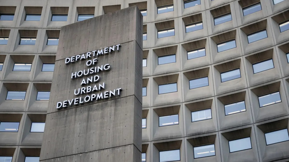
US President Harry S. Truman signed the Housing Act of 1949, significantly expanding the federal government’s role in housing policy, urban planning and real estate development. The landmark legislation established the provision of a decent home and a suitable living environment for every America...
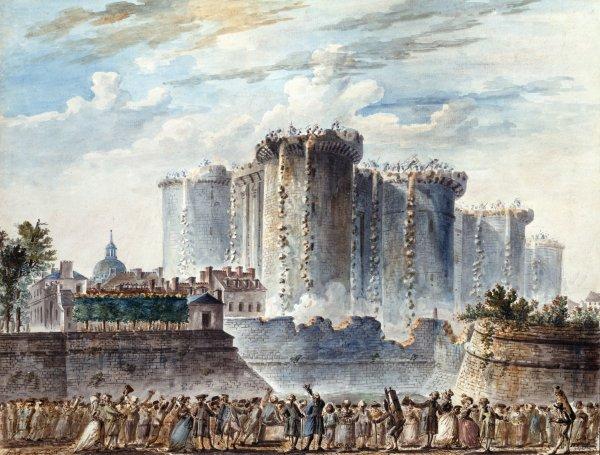
Citizens of Paris stormed and captured the Bastille, a fortified royal prison that had become one of the most powerful symbols of absolute monarchy. The event became a defining moment of the French Revolution, but it also marked a major transformation in the urban and architectural history of Paris....

The International Olympic Committee selected Beijing, China, to host the 2008 Summer Olympic Games during its 112th Session in Moscow. The decision became a major turning point in Beijing’s modern urban development and built environment. Winning the Olympic bid accelerated the redevelopment of ...
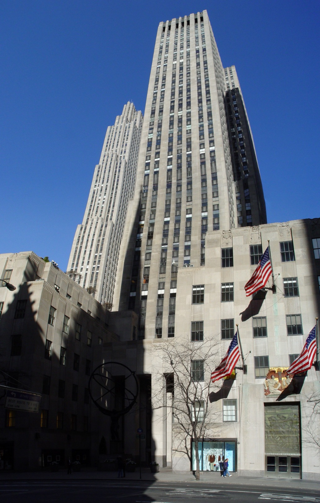
A ceremonial groundbreaking was held for Palazzo d’Italia, an Italian themed commercial building planned as part of Rockefeller Center’s International Complex on Fifth Avenue in New York City. The ceremony marked an important stage in the expansion of one of the twentieth century’s most influe...
On 11 July 2007, global attention turned towards one of the most significant demographic transformations in human history: the world was entering an era in which more people would live in urban areas than in rural communities. A World Bank feature published that day, drawing on new United Nations p...
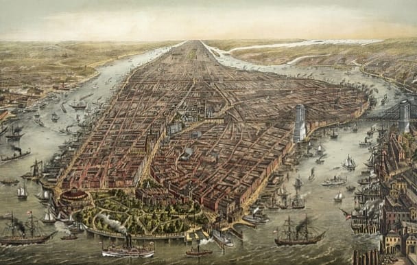
On 10 July 1690, authority in the Province of New York shifted firmly under the government established in the name of King William III and Queen Mary II during the aftermath of the Glorious Revolution. Although this was primarily a political event, it had lasting consequences for the future of land ...
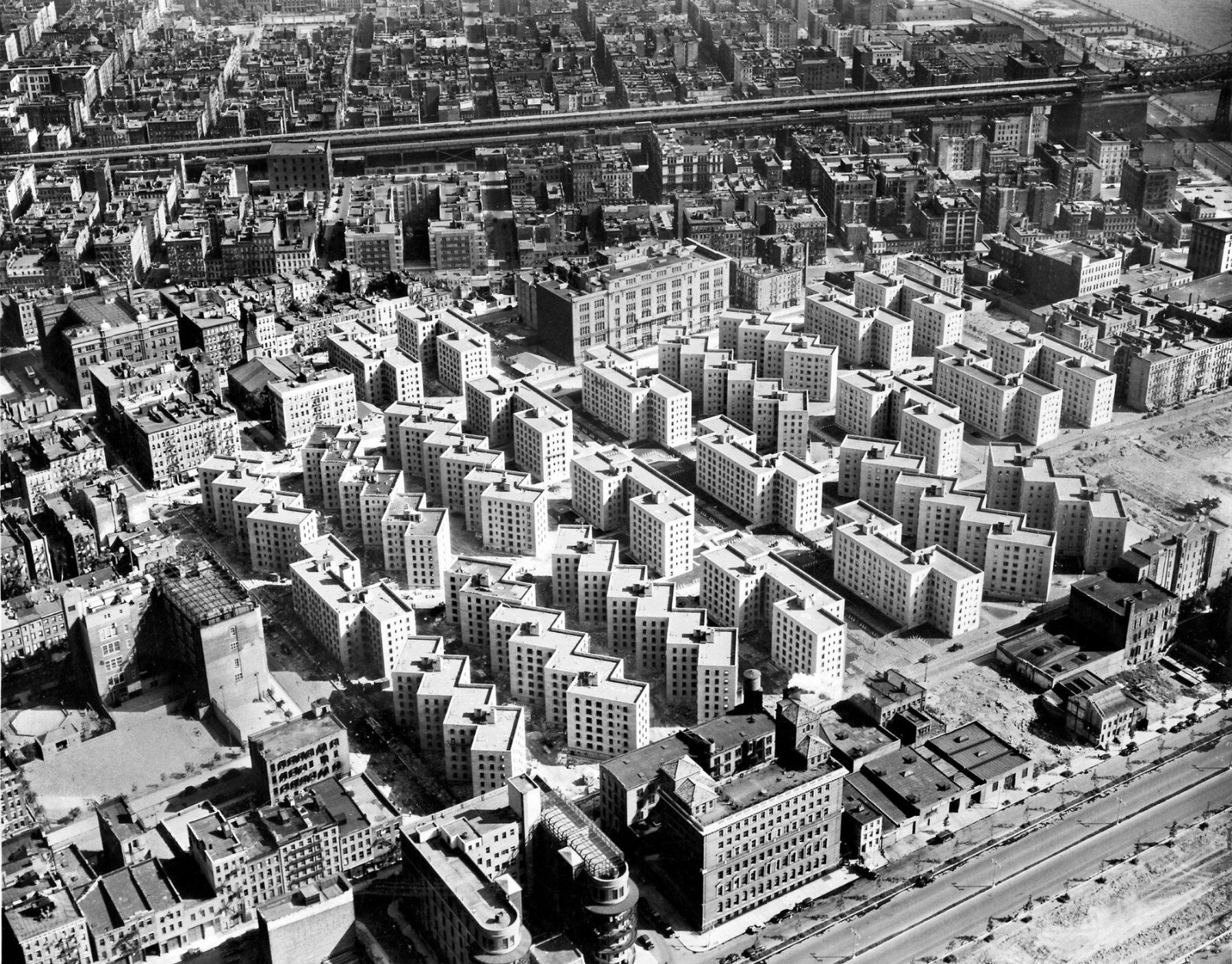
The United States Housing Corporation was legally created, marking an important moment in the history of public housing, planned residential development and modern urban policy in the United States. The corporation was established during World War I, when America’s defence industries, arsenals, s...
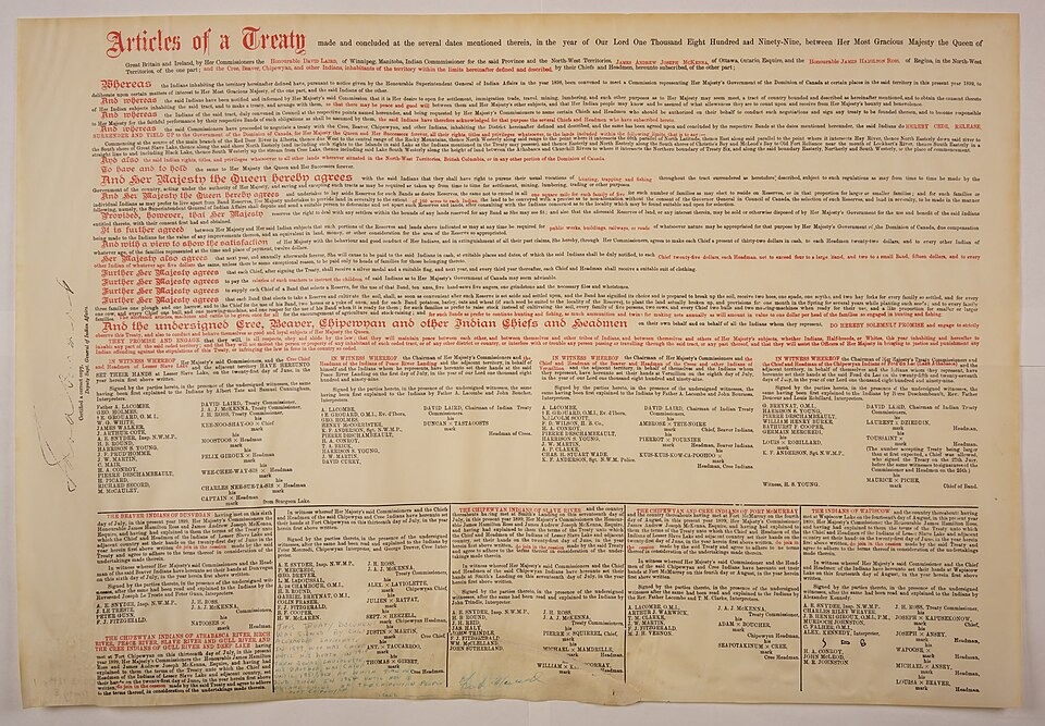
An important adhesion to Treaty 8 was signed at Fort Vermilion in northern Alberta, Canada. Treaty 8 had originally been signed on June 21, 1899, at Lesser Slave Lake, but it was later extended through separate adhesions in different northern communities. The Fort Vermilion adhesion was one of those...

Hoover Dam was named after Herbert Hoover, the 31st President of the United States, who strongly supported the project before becoming president. The dam was also called Boulder Dam for some years, but in 1947 the U.S. Congress officially restored the name Hoover Dam. Preliminary construction work ...

The Kilmarnock and Troon Railway officially opened in Ayrshire, Scotland. It is widely regarded as Scotland’s first public railway line and one of the early transport projects that helped shape the relationship between infrastructure, land value and industrial development. The line connected Kilma...
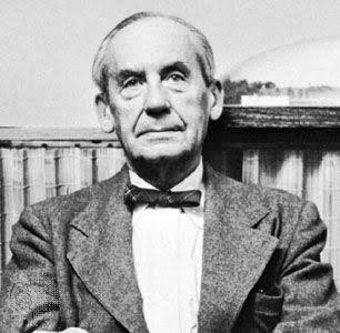
On 5 July 1969, Walter Gropius, one of the most influential figures in modern architecture, urban planning and real estate design, passed away in Boston. Gropius was a German born architect, urban thinker and founder of the Bauhaus School, one of the most important design movements of the twentieth ...
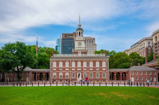
One of the most important moments in modern political and urban history took place inside Independence Hall in Philadelphia, United States. On this day, the Declaration of Independence was approved, turning a civic building into a global symbol of freedom, public authority and national identity. Th...

On 3 July 1919, Helical Bar and Engineering Company Limited was incorporated in London. The company was originally established to manufacture and sell reinforcing steel for the construction industry, supporting building activity at a time when modern urban development was expanding across Britain. ...
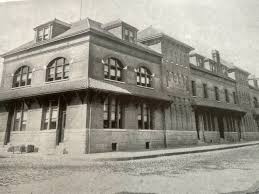
1979: The Hoboken Land and Improvement Company Building in New Jersey was added to the National Register of Historic Places, recognising its architectural, commercial and urban development significance. Built in 1889, the building served as the office of the Hoboken Land and Improvement Company, a ...
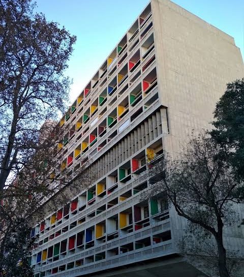
La Maison Radieuse, a major collective housing project designed by renowned architect Le Corbusier, was inaugurated in Rezé near Nantes, France. The building became the second major example of Le Corbusier’s Unité d’Habitation concept, following his earlier work in Marseille, and reflected a b...
© syedshayan.com


.jpg)


.jpg)


.jpg)
.jpg)
.jpg)


.jpg)