
Syed Shayan Real Estate Archive
Syed Shayan Real Estate Archive
From Real Estate History

On 27 January 1888, the National Geographic Society was established in Washington DC. The purpose of this institution was to advance understanding of the world’s lands, mountains, rivers, cities, regions, and the human and wildlife populations inhabiting them, and to document this knowledge through systematic mapping. Prior to this, land was generally perceived as a static physical space. National Geographic introduced the idea that land could be measured, recorded with accuracy, and scientifically assessed to determine its most appropriate uses.
As a result of this intellectual effort, a clearer understanding gradually emerged of where cities should expand, where roads should be constructed, where agriculture could develop most effectively, and how land value could be determined. In simple terms, National Geographic helped establish the idea that land is not merely soil, but a valuable asset that can be planned, analysed, and managed.
In its early work, National Geographic produced accurate maps, conducted precise land measurements, and clarified where the boundaries of regions begin and end. It also explained which land was better suited for housing, which for agriculture, and which for industry or transport infrastructure, a process now understood as land use classification.
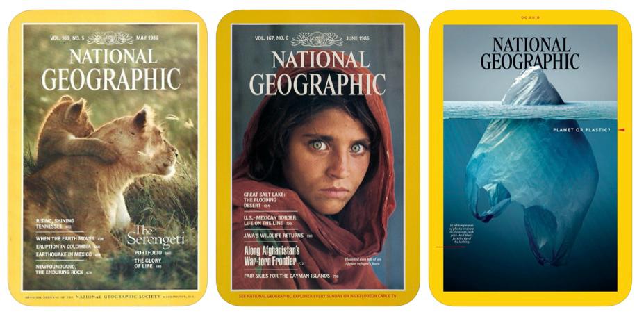
Published by the National Geographic Society, National Geographic represents a benchmark in documentary and research based journalism.These three covers collectively document the magazine’s intellectual progression, tracing its focus from the natural world and wildlife, to human experience shaped by conflict, and finally to contemporary environmental challenges, particularly plastic pollution.Viewed together, they express a consistent archival theme that the Earth, human society, and the environment exist as an interconnected system, each shaping and influencing the other over time.
Once these principles became established, it became easier to pursue planned urban expansion, divide areas into functional zones, and formulate land related laws and regulations. People began to understand why cities often develop near rivers, coastlines, mountains, transport routes, and natural resources, and why certain locations become more important and valuable than others, commonly described as strategic locations.
National Geographic further demonstrated that land value is not determined solely by location, but by the characteristics present within it, including water systems, soil fertility, and the availability of mineral resources. This perspective introduced a scientific method for assessing the economic value of land and its investment potential.
Later, with the introduction of aerial photography through aircraft, followed by satellite based observation, geographical data relating to land became increasingly precise. On this foundation, modern digital land records and contemporary land administration systems were developed.
In essence, National Geographic taught the world that land is not simply a piece of earth, but a geographical asset and a resource based form of capital that can be understood and utilised through informed planning. This approach continues to underpin real estate valuation, urban expansion, and policy formulation today.
National Geographic is also widely recognised for its photography, documentaries, and research on animals, forests, land, oceans, and the natural environment.
Cartography has remained an important part of National Geographic’s work, an area in which the institution developed considerable expertise over time. Through its globally renowned magazine National Geographic, the Society published maps distinguished by clarity, accuracy, and rigorous research. These maps were not intended for routine government use, but were designed to help readers understand the world, its regions, oceans, borders, and natural systems. As a result, they were widely trusted and used by educational institutions, researchers, and the general public. Although mapmaking was not the Society’s central function, the quality of the maps published in its magazine significantly strengthened its reputation and established it as a serious and credible scholarly institution worldwide.
The idea of forming the National Geographic Society emerged in 1888 in Washington DC among a group of geographers, scientists, and intellectuals, most notably Gardiner Greene Hubbard, who became its first president. Their objective was to understand and explain, on a scientific basis, the relationship between the world, land, nature, and humanity.
The National Geographic Society is a non profit, public, and educational institution that does not operate under any government authority. Its funding is derived from public donations, membership fees, publishing and media revenue, and research grants. These resources support its staff, research activities, documentaries, and fieldwork. Owing to this autonomous structure, it is widely regarded as an independent, credible, and impartial scholarly institution.
▪️Syed Shayan Real Estate Archive
▪ Reference(s):
27 جنوری 1888 کو واشنگٹن ڈی سی میں نیشنل جیوگرافک سوسائٹی قائم کی گئی۔ اس ادارے کا مقصد یہ تھا کہ دنیا کی زمینوں، پہاڑوں، دریاؤں، شہروں، مختلف علاقوں اور ان میں آباد انسانی اور جنگلی حیات کو بہتر طور پر سمجھا جا سکے اور ان کے نقشے تیار کیے جائیں۔ اس سے پہلے لوگ زمین کو محض ایک جگہ سمجھتے تھے، لیکن نیشنل جیوگرافک نے یہ تصور متعارف کرایا کہ زمین کو ناپا جا سکتا ہے، اس کا درست ریکارڈ رکھا جا سکتا ہے، اور یہ جانچا جا سکتا ہے کہ کون سی زمین کس استعمال کے لیے زیادہ موزوں ہے۔
اسی علمی کام کے نتیجے میں بعد ازاں یہ سمجھ پیدا ہوئی کہ شہروں کو کہاں پھیلانا چاہیے، سڑکیں کہاں بننی چاہئیں، زراعت کہاں بہتر ہو سکتی ہے اور زمین کی قیمت کیسے طے ہوتی ہے۔ آسان الفاظ میں، نیشنل جیوگرافک نے لوگوں کو یہ سکھایا کہ زمین صرف مٹی نہیں ہوتی بلکہ ایک قیمتی اثاثہ ہوتی ہے، جس کی منصوبہ بندی کی جا سکتی ہے۔
نیشنل جیوگرافک نے ابتدائی طور پر زمین کے درست نقشے تیار کیے، زمین کی صحیح پیمائش کی، اور یہ واضح کیا کہ کسی علاقے کی حدود کہاں سے شروع ہوتی ہیں اور کہاں ختم ہوتی ہیں، جسے زمین کی حد بندی کہا جاتا ہے۔ اس نے یہ بھی بتایا کہ کون سی زمین رہائش کے لیے بہتر ہے، کون سی کھیتی باڑی کے لیے، اور کون سی صنعت یا سڑکوں کے لیے استعمال ہونی چاہیے، جسے زمین کے استعمال کی درجہ بندی کہا جاتا ہے۔
جب یہ تمام پہلو واضح ہوئے تو شہروں کی منصوبہ بندی کے ساتھ توسیع، علاقوں کی زوننگ، اور زمین سے متعلق قوانین کی تشکیل میں آسانی پیدا ہوئی۔ لوگوں کو یہ سمجھ آنے لگی کہ شہر اکثر دریاؤں، ساحلوں، پہاڑوں، راستوں اور قدرتی وسائل کے قریب کیوں بنتے ہیں، اور کیوں کچھ مقامات زیادہ اہم اور قیمتی ہو جاتے ہیں، جنہیں اسٹریٹجک لوکیشن کہا جاتا ہے۔
نیشنل جیوگرافک نے یہ بھی واضح کیا کہ زمین کی قیمت محض جگہ کی بنیاد پر نہیں ہوتی بلکہ اس کا تعلق وہاں موجود خصوصیات سے ہوتا ہے، جیسے پانی کا نظام، مٹی کی زرخیزی اور معدنی وسائل کی دستیابی۔ اس طرح زمین کی معاشی قدر اور اس پر سرمایہ کاری کی صلاحیت کو جانچنے کا ایک سائنسی طریقہ سامنے آیا۔
نیشنل جیوگرافک سوسائٹی کا مشہورِ زمانہ میگزین National Geographic دستاویزی اور تحقیقی صحافت کی اعلیٰ ترین مثال ہے۔ اس میگزین کے یہ تین سرورق اس کے فکری سفر کو ظاہر کرتے ہیں، جہاں فطرت، انسان اور ماحول کو ایک دوسرے سے جڑے ہوئے موضوعات کے طور پر پیش کیا گیا ہے یہ تینوں سرورق نیشنل جیوگرافک کی سوچ میں آنے والی تبدیلی کو دکھاتے ہیں۔ پہلا سرورق جنگلی جانوروں اور قدرتی ماحول کی بات کرتا ہے، دوسرا انسان اور جنگ سے جڑی مشکلات کو دکھاتا ہے، اور تیسرا آج کے دور کے ماحولیاتی مسئلے، خاص طور پر پلاسٹک کی آلودگی، کی طرف اشارہ کرتا ہے۔ ان سب کا ایک ہی پیغام ہے کہ زمین، انسان اور ماحول آپس میں جڑے ہوئے ہیں اور ایک دوسرے پر اثر انداز ہوتے ہیں۔
بعد ازاں جب ہوائی جہازوں سے تصویریں لینے کا عمل شروع ہوا، یعنی فضائی فوٹوگرافی، اور پھر سیٹلائٹ کے ذریعے مشاہدہ ممکن ہوا تو زمین سے متعلق جغرافیائی ڈیٹا مزید درست ہوتا چلا گیا۔ اسی بنیاد پر آج کے ڈیجیٹل لینڈ ریکارڈ اور جدید لینڈ ایڈمنسٹریشن کے نظام وجود میں آئے۔
سادہ الفاظ میں، نیشنل جیوگرافک نے دنیا کو یہ سکھایا کہ زمین صرف مٹی کا ایک ٹکڑا نہیں بلکہ ایک جغرافیائی اثاثہ اور وسائل پر مبنی سرمایہ ہے، جسے سمجھ کر اور منصوبہ بندی کے ساتھ استعمال کیا جا سکتا ہے۔ یہی سوچ آج بھی رئیل اسٹیٹ ویلیوایشن، شہری توسیع اور پالیسی سازی کی بنیاد بنی ہوئی ہے۔
نیشنل جیوگرافک کو دنیا بھر میں جانوروں، جنگلات، زمینوں، سمندروں اور قدرتی ماحول پر کی گئی فوٹوگرافی، ڈاکیومنٹریز اور تحقیقی کام کی وجہ سے بھی سراہا جاتا ہے۔
نقشہ سازی بھی نیشنل جیوگرافک کی سرگرمیوں کا ایک اہم حصہ رہی ہے، جس میں اس ادارے نے وقت کے ساتھ خاص مہارت حاصل کی۔ نیشنل جیوگرافک سوسائٹی نے اپنے معروف اور عالمی سطح پر مشہور میگزین نیشنل جیوگرافک کے ذریعے ایسے نقشے شائع کیے جو واضح انداز، درست معلومات اور گہری تحقیق پر مبنی ہوتے تھے۔ یہ نقشے روزمرہ سرکاری استعمال کے لیے نہیں تھے بلکہ دنیا، مختلف خطوں، سمندروں، سرحدوں اور قدرتی نظام کو سمجھانے کے لیے تیار کیے جاتے تھے۔ اسی لیے تعلیمی اداروں، محققین اور عام قارئین نے انہیں بڑے اعتماد کے ساتھ استعمال کیا۔ یوں اگرچہ نقشہ سازی نیشنل جیوگرافک کا مرکزی کام نہیں تھی، مگر اس کے میگزین میں شائع ہونے والے معیاری نقشوں نے اس ادارے کی ساکھ کو مضبوط کیا اور اسے عالمی سطح پر ایک معتبر اور سنجیدہ علمی ادارے کے طور پر شناخت دلائی۔
نیشنل جیوگرافک سوسائٹی قائم کرنے کا خیال 1888 میں واشنگٹن ڈی سی میں چند ماہرینِ جغرافیہ، سائنس دانوں اور دانشوروں کو آیا، جن میں سب سے نمایاں نام گارڈنر گرین ہبارڈ کا تھا، جو اس کے پہلے صدر بنے۔ ان افراد کا مقصد یہ تھا کہ دنیا، زمین، فطرت اور انسان کے باہمی تعلق کو سائنسی بنیادوں پر سمجھا اور سمجھایا جائے۔
نیشنل جیوگرافک سوسائٹی ایک غیر منافع بخش، عوامی اور تعلیمی ادارہ ہے جو کسی حکومت کے تحت نہیں چلتا۔ اس کی مالی معاونت عوامی عطیات، ممبرشپ فیس، اشاعتی اور میڈیا آمدن، اور تحقیقی گرانٹس سے ہوتی ہے۔ انہی ذرائع سے اس کا اسٹاف، تحقیق، ڈاکیومنٹریز اور فیلڈ ورک چلایا جاتا ہے۔ اسی خود مختار حیثیت کی وجہ سے اسے دنیا بھر میں ایک آزاد، معتبر اور غیر جانبدار علمی ادارہ سمجھا جاتا ہے۔
▪️ سید شایان ریئل اسٹیٹ آرکائیو
In 1947, the partition of the subcontinent divided Bengal into two parts, West Bengal and East Bengal, later known as East Pakistan. The system of land ownership had been severely disrupted. Large scale migration left millions of acres of land without resident owners, as many had crossed the newly drawn borders. These abandoned properties quickl...
Read More →
On November 6, 1995, the Government of Sindh embarked on one of the most ambitious urban land reform programs in Pakistan’s history the Karachi Katchi Abadi Regularization and Land Titling Initiative. The campaign was designed to bring hundreds of informal settlements, locally known as katchi abadis, into the legal urban framework. These settleme...
Read More →
On November 22, 1983, the French Ministry of Transport unveiled a nationwide rail safety modernization blueprint to respond to rising commuter volumes and expanding suburban zones around major cities including Paris, Lyon, and Marseille. The early 1980s had seen frequent near-accident incidents due to outdated signalling systems, manual switching i...
Read More →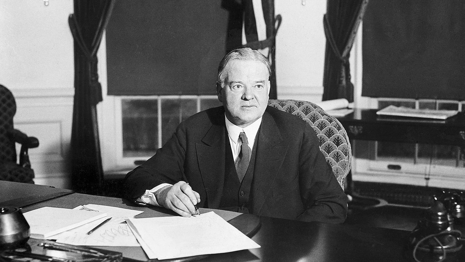
Amid the continuing economic crisis, President Herbert Hoover inaugurated the White House Conference on Home Building and Home Ownership today in Washington. The nationwide conference brought together more than three thousand specialists in construction, housing finance, urban planning and land law. The opening session emphasised that although the ...
Read More →
The structure known globally today as Burj Khalifa was originally conceived and launched under the name Burj Dubai. An important and deliberate aspect of its history is that the inauguration was scheduled for 4 January 2010 to coincide with the anniversary of Sheikh Mohammed bin Rashid Al Maktoum’s accession as Ruler of Dubai. On 4 January 2006,...
Read More →
The acquisition of land for the Model Town Society was one of the most remarkable and spirited chapters in its early history. Dewan Khem Chand and his...

Between 1921 and 1924, the land for Model Town Lahore was acquired in successive phases. The process began in 1921, shortly after the establishment of...
No comments yet. Be the first to comment!