
Syed Shayan Real Estate Archive
Syed Shayan Real Estate Archive
From Real Estate History
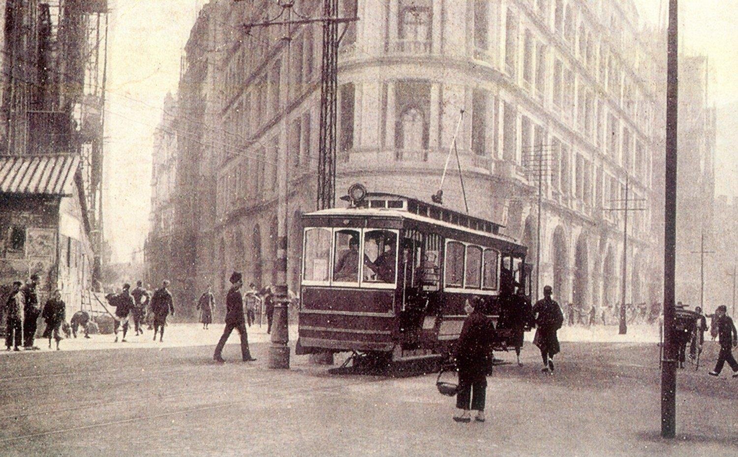
Hong Kong’s first electric tram began operating, marking an important moment in the history of the city’s transport system, urban planning and property development. The original fleet consisted of 26 single deck tramcars, while the first route connected Kennedy Town with Causeway Bay. The line was later extended eastwards to Shau Kei Wan.
The tram travelled along the northern side of Hong Kong Island, where the harbour, government offices, markets, business districts and residential communities were expanding. Before the service began, travel between different parts of the city depended on slower and less predictable forms of transport. The tram introduced a more affordable, regular and reliable way for residents to move between their homes and workplaces.
From a real estate perspective, improved accessibility was one of the most significant effects of the new system. Land and buildings located near the tram route became more useful for housing, retail and commercial activity. Workers could live farther from the central business areas while continuing to travel conveniently each day.
Businesses located near tram stops also benefited from increased pedestrian movement and a larger flow of potential customers. Shops, offices and services were encouraged to concentrate along the transport corridor, helping create active commercial streets and more densely developed neighbourhoods.
As Hong Kong continued to grow, areas connected by the tram attracted additional residential buildings, markets and community facilities. Public transport therefore did more than respond to existing demand. It helped determine where future development would take place and how different parts of the city would be connected.
The original single deck vehicles were later replaced by the double deck trams that became one of Hong Kong’s most recognisable urban features. Known locally as “Ding Ding” because of the sound of their bells, the trams remained closely associated with the city’s identity and everyday life for more than a century.
The opening of the tramway on July 30, 1904, demonstrates a lasting principle of real estate development: dependable public transport can increase accessibility, strengthen property demand, support commercial growth and influence the long term pattern of urban expansion.
▪️Syed Shayan Real Estate Archive
30 جولائی 1904 کو ہانگ کانگ کی سڑکوں پر پہلی برقی ٹرام نے سفر شروع کیا اور شہر کی نقل و حمل، شہری منصوبہ بندی اور رئیل اسٹیٹ کی تاریخ میں ایک اہم باب کا اضافہ ہوا۔ ابتدائی نظام میں 26 یک منزلہ ٹرامیں شامل تھیں، جبکہ پہلا راستہ کینیڈی ٹاؤن سے کازوے بے تک قائم کیا گیا۔ بعد میں اسے شاؤ کی وان تک توسیع دے دی گئی۔
ٹرام کا راستہ ہانگ کانگ جزیرے کے شمالی ساحلی علاقے سے گزرتا تھا، جہاں بندرگاہ، تجارتی مراکز، سرکاری دفاتر، بازار اور رہائشی بستیاں تیزی سے پھیل رہی تھیں۔ اس سے قبل شہریوں کو مختلف علاقوں کے درمیان سفر کے لیے نسبتاً سست اور محدود ذرائع پر انحصار کرنا پڑتا تھا۔ ٹرام نے سفر کو زیادہ باقاعدہ، سستا اور قابل اعتماد بنا دیا۔
رئیل اسٹیٹ کے نقطہ نظر سے ٹرام کے آغاز کا سب سے اہم اثر شہری زمین تک رسائی میں بہتری تھا۔ جن علاقوں کو نئی ٹرام لائن سے رابطہ ملا، وہاں رہائشی اور تجارتی جائیدادوں کی افادیت بڑھنے لگی۔ لوگ مرکزی کاروباری علاقوں سے نسبتاً دور رہائش اختیار کر کے روزانہ کام پر آ جا سکتے تھے، جبکہ دکانوں اور دفاتر کو ٹرام اسٹاپس کے قریب زیادہ گاہک اور بہتر کاروباری مواقع میسر آنے لگے۔
وقت کے ساتھ ٹرام کے راستے سے منسلک محلوں میں کثیرالمنزلہ رہائش، تجارتی عمارتوں، بازاروں اور عوامی سہولتوں کی ترقی نے رفتار پکڑی۔ اس طرح ٹرانسپورٹ انفراسٹرکچر نے صرف موجودہ آبادی کی ضروریات پوری نہیں کیں بلکہ مستقبل میں شہر کے پھیلاؤ کی سمت بھی متعین کی۔
ابتدائی یک منزلہ ٹراموں کی جگہ بعد میں دو منزلہ ٹراموں نے لے لی، جو اپنی گھنٹی کی آواز کے باعث مقامی طور پر “ڈنگ ڈنگ” کے نام سے مشہور ہوئیں۔ یہ ٹرامیں ایک صدی سے زیادہ عرصے کے دوران ہانگ کانگ کی شہری شناخت اور روزمرہ زندگی کا مستقل حصہ بنی رہیں۔
30 جولائی 1904 کا واقعہ اس اصول کی نمایاں مثال ہے کہ جدید پبلک ٹرانسپورٹ کسی شہر میں صرف آمدورفت بہتر نہیں کرتی بلکہ زمین کی قدر، جائیداد کی طلب، تجارتی سرگرمی اور رہائشی ترقی کو بھی نئی شکل دیتی ہے۔
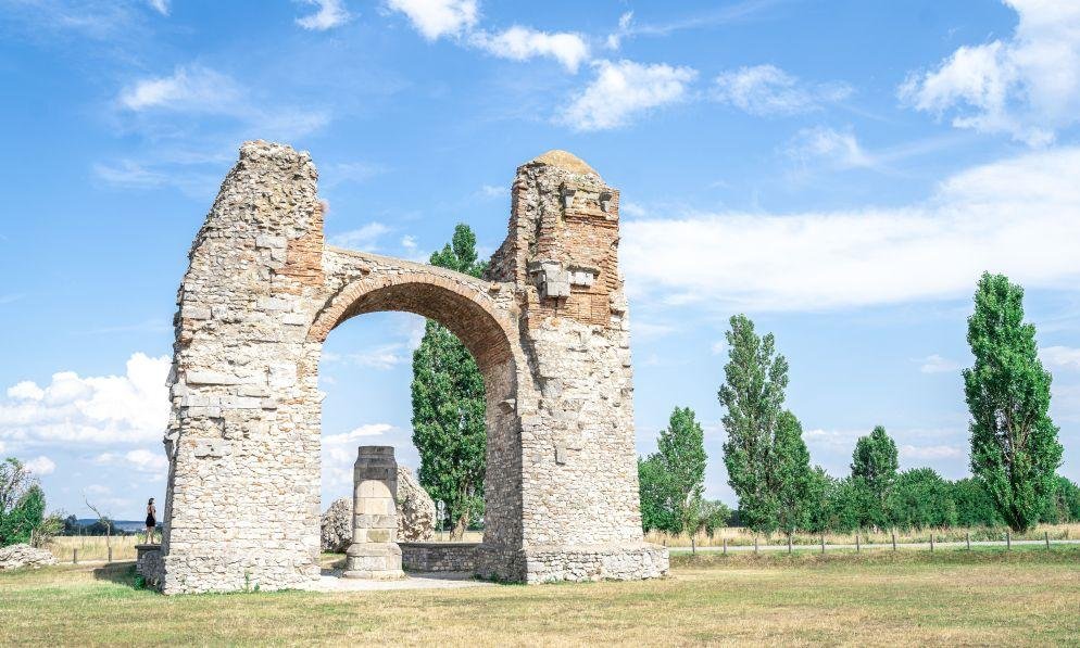
UNESCO added the western section of the Roman Empire’s Danube frontier to the World Heritage List. Extending for almost 600 kilometres across Germany, Austria and Slovakia, the historic property comprises 77 significant locations, including military fortresses, smaller forts, watchtowers, roads, temporary camps and civilian settlements that developed around Roman defensive centres.
The frontier was established and expanded between the first and fifth centuries to protect and administer the northern limits of the Roman Empire. However, the sites did not remain isolated military installations. Soldiers required food, equipment, services and accommodation, attracting traders, craftspeople, labourers and families to the surrounding land.
Markets, houses, public baths, places of worship, storage buildings and other community facilities gradually appeared near the forts. Some of these settlements developed into permanent towns, while former military roads continued to influence travel, trade and the location of later communities.
From a real estate history perspective, the Danube frontier demonstrates how major government infrastructure can determine land use and direct urban growth. Fortresses acted as employment and commercial centres, while roads improved access to strategically important locations. As a result, the value and usefulness of surrounding land increased, encouraging residential and commercial development.
During the medieval period, several Roman structures and building materials were reused in new construction. In some places, later settlements were built directly over or around the remains of Roman military sites. Their street patterns, defensive boundaries and building locations therefore continued to shape the physical form of European towns long after the Roman administration had disappeared.
World Heritage status placed greater emphasis on coordinated conservation, archaeological protection and controlled development around the historic locations. New roads, buildings, utilities and commercial projects near protected sites must now be considered alongside the historical and cultural value of the land.
The Danube frontier remains a powerful example of how historic property can serve modern communities. With careful planning, ancient buildings and archaeological landscapes can support tourism, local employment and heritage led regeneration without losing the character that makes them valuable.
▪️Syed Shayan Real Estate Archive
30 جولائی 2021 کو یونیسکو نے دریائے ڈینیوب کے ساتھ پھیلی قدیم رومی سلطنت کی مغربی سرحد کو عالمی ثقافتی ورثے کی فہرست میں شامل کیا۔ تقریباً 600 کلومیٹر طویل یہ تاریخی علاقہ جرمنی، آسٹریا اور سلوواکیہ تک پھیلا ہوا ہے اور اس میں 77 اہم مقامات شامل ہیں۔ ان مقامات میں بڑے فوجی قلعے، چھوٹی دفاعی چوکیاں، نگرانی کے برج، فوجی راستے، عارضی کیمپ اور ان کے اطراف آباد ہونے والی شہری بستیاں شامل ہیں۔
یہ تعمیراتی سلسلہ پہلی سے پانچویں صدی عیسوی کے دوران رومی سلطنت کی شمالی سرحد کی نگرانی اور حفاظت کے لیے قائم کیا گیا تھا۔ تاہم وقت گزرنے کے ساتھ یہ علاقہ صرف فوجی دفاع تک محدود نہیں رہا۔ فوجی مراکز کے قریب تاجروں، کاریگروں، مزدوروں اور ان کے خاندانوں نے رہائش اختیار کی، جس کے نتیجے میں بازار، مکانات، حمام، عبادت گاہیں، گودام اور دیگر شہری سہولتیں وجود میں آئیں۔
رئیل اسٹیٹ تاریخ کے اعتبار سے ڈینیوب لائمز ایک اہم مثال ہے کہ سرکاری انفراسٹرکچر اور دفاعی تنصیبات کس طرح زمین کے استعمال اور شہری آبادی کی سمت متعین کرتی ہیں۔ فوجی سڑکوں نے مختلف علاقوں کو باہم منسلک کیا، جبکہ قلعوں کے گرد آباد ہونے والی بستیاں وقت کے ساتھ مستقل قصبوں میں تبدیل ہو گئیں۔ کئی مقامات پر قرون وسطیٰ کے دوران قدیم رومی عمارتوں کی بنیادوں اور تعمیراتی مواد کو دوبارہ استعمال کیا گیا، جس سے جدید یورپی شہروں کی ساخت پر بھی رومی دور کے اثرات برقرار رہے۔
یونیسکو کی جانب سے عالمی ورثے کا درجہ ملنے کے بعد ان تاریخی مقامات کے اطراف نئی تعمیرات، سڑکوں، تجارتی منصوبوں اور زمین کے استعمال کے لیے زیادہ محتاط منصوبہ بندی ضروری ہو گئی۔ آثار قدیمہ کے تحفظ کے ساتھ مقامی آبادی کی ضروریات، سیاحت اور اقتصادی سرگرمیوں میں توازن پیدا کرنا بھی انتظامیہ کے لیے اہم چیلنج بن گیا۔
ڈینیوب کی رومی سرحد آج اس حقیقت کی یاد دہانی کراتی ہے کہ تاریخی زمین اور عمارتیں محض ماضی کی نشانیاں نہیں ہوتیں۔ مناسب تحفظ اور منصوبہ بندی کے ذریعے انہیں سیاحت، مقامی روزگار اور ورثے پر مبنی شہری ترقی کے پائیدار اثاثوں میں تبدیل کیا جا سکتا ہے۔
یہ22 اکتوبر 1888 کی بات ہے جب بڑے شہروں میں عمارتوں کی اونچائی محدود کرنے کے ابتدائی قوانین نافذ کیے گئے۔ ان قوانین کے ذریعے پہلی بار عمارتوں کی بلندی پر باقاع...
مزید پڑھیں
9 اکتوبر 1874 کو سوئٹزرلینڈ کے شہر برن میں بائیس ممالک کے نمائندے جمع ہوئے تاکہ یونیورسل پوسٹل یونین (UPU) قائم کی جا سکے۔ ایک تاریخی عالمی فریم ورک جس نے بین ا...
مزید پڑھیں
اکتوبر 1939 میں جب دوسری عالمی جنگ کے بادل برصغیر پر چھا گئے، لاہور برطانوی پنجاب کا نہ صرف انتظامی مرکز تھا بلکہ فوجی و تجارتی سرگرمیوں کا بھی اہم گڑھ تھا۔ ا...
مزید پڑھیں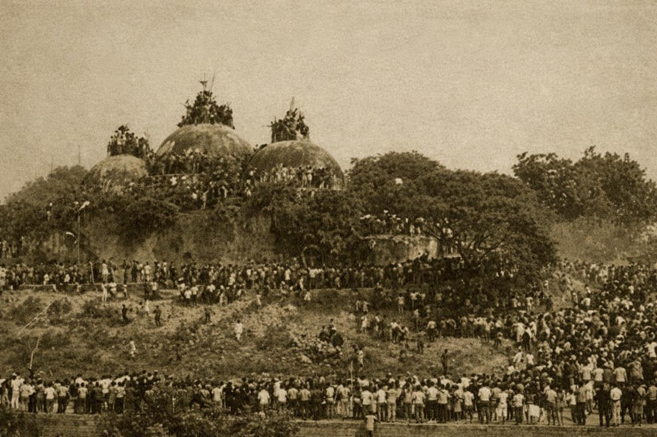
6 دسمبر 1992 کو بھارت کے شہر ایودھیا میں واقع تاریخی بابری مسجد کو ایک ہجوم کے ہاتھوں شہید کر دیا گیا۔ یہ واقعہ برصغیر کی جدید تاریخ میں مسلمانوں کے لیے ایک ش...
مزید پڑھیں
گورنمنٹ آف انڈیا کے گزٹ پارٹ ون میں 28 نومبر 1903 کو شائع ہونے والے نوٹیفکیشن کے مطابق ایسٹ انڈین ریلوے نے ہاوڑہ اور لِللوا کے درمیانی خطے میں پہلی مرتبہ بڑے پی...
مزید پڑھیں
ماڈل ٹاؤن لاہور ایک جدید رہائشی سوسائٹی جو لاہور کے قدیمی جنگل میں بسائی گئی ماڈل ٹاؤن سوسائٹی کے لیے زمین کی خریداری اور حصول بھی ایک نہایت ...
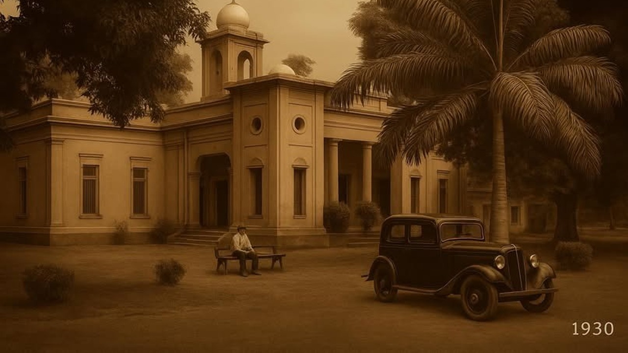
ماڈل ٹاؤن سوسائٹی کی 500 ایکڑ زمین کہاں گئی؟ ماڈل ٹاؤن لاہور کی زمین 1921 سے 1924 کے درمیان مختلف مرحلوں میں خریدی گئی۔ ابتدا 1921 میں ہوئی جب...
No comments yet. Be the first to comment!