
Syed Shayan Real Estate Archive
Syed Shayan Real Estate Archive
From Real Estate History
5 Historical Event found
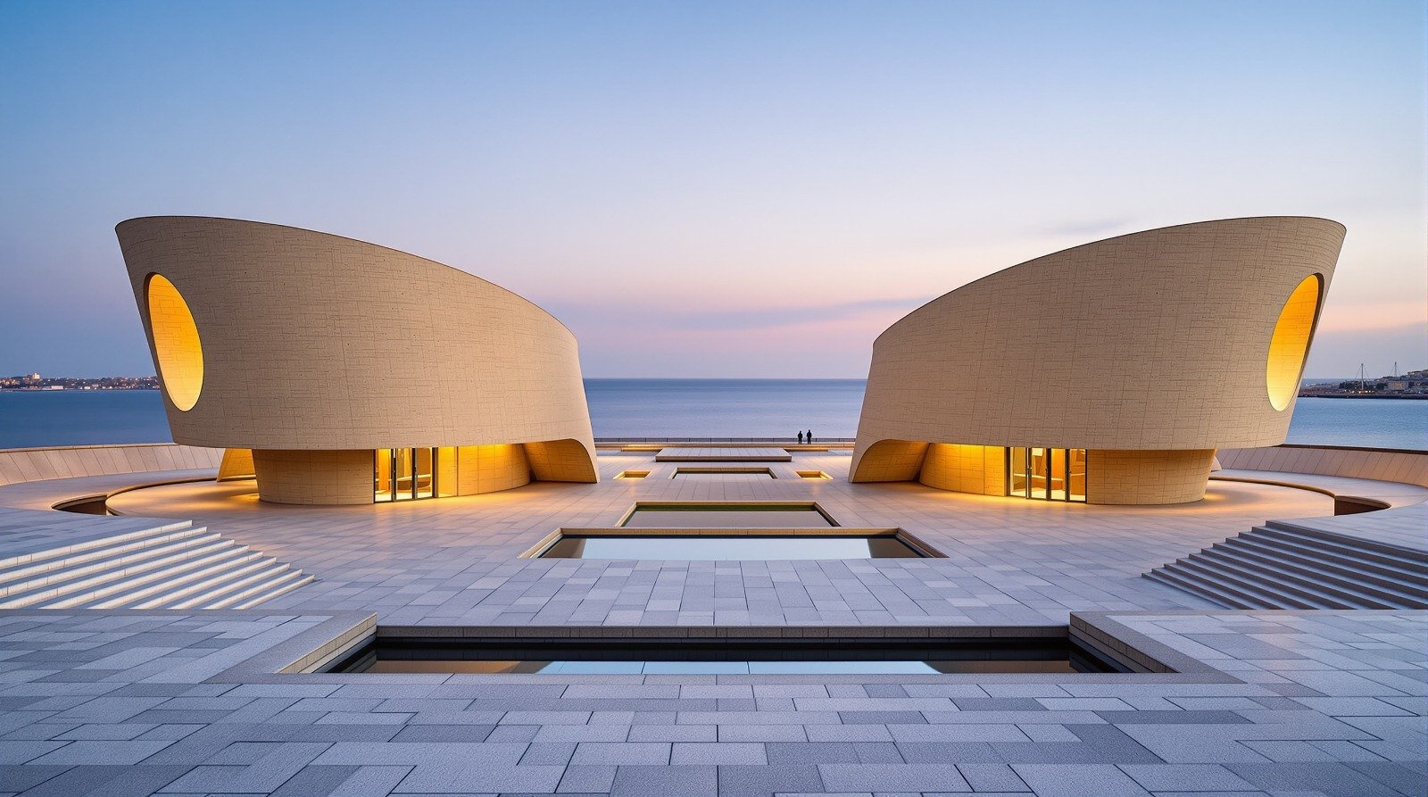
On October 5, 2010, the Champalimaud Centre for the Unknown, designed by renowned Indian architect Charles Correa, was officially inaugurated in Lisbon, Portugal, creating a major new complex that combines contemporary architecture, scientific research, and the city’s historic waterfront. The Centre was built in Lisbon’s historic Belém riverside area, where the Tagus River meets the Atlantic Ocean. The location carries particular historical significance as the area from which Portuguese navigators once departed on voyages of exploration. Indian architect Charles Correa was selected to design the project. One of the most influential figures in modern South Asian architecture and urban planning, Correa was also behind projects including the Kanchanjunga apartment tower in Mumbai, Jawahar Kala Kendra in Jaipur and the Gandhi Memorial at Sabarmati Ashram in Ahmedabad. The first stone for the Champalimaud Centre was laid on October 5, 2008. Exactly two years later, on October 5, 2010, the complex was formally inaugurated. The Centre was conceived as an advanced medical, scientific and technological facility, bringing research laboratories, clinical facilities, teaching spaces and administrative functions together in an environment designed to encourage interaction between researchers, scientists and medical professionals. Correa placed particular emphasis on the relationship between the architecture and its location. The buildings and surrounding open spaces were designed to engage with the Tagus waterfront and the Atlantic beyond, while landscaped public areas restored access to an important section of Lisbon’s riverside. The complex consists of two principal building blocks connected by an elevated walkway, alongside landscaped areas and an outdoor amphitheatre, integrating institutional architecture with public space. Its inauguration was deliberately held on the centenary of the Portuguese Republic, giving the October 5 opening additional symbolic significance. The project also reflected Correa’s broader architectural philosophy that major buildings should respond not only to their functional requirements but also to the history, culture, landscape and urban character of their surroundings. The inauguration of the Champalimaud Centre for the Unknown on October 5, 2010, therefore marked an important addition to Lisbon’s contemporary built environment and became a notable international work in the architectural legacy of Charles Correa. Source(s) : Champalimaud Foundation
Read More >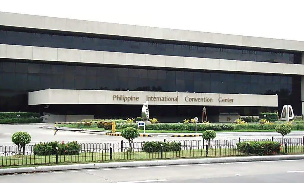
On September 5, 1976, the Philippine International Convention Center (PICC) officially opened in Manila, Philippines. Located along Manila Bay, it became Asia’s first international convention center and represented far more than a new building. It was part of the Philippines’ effort to establish Manila as an important destination for major international gatherings, diplomatic meetings and global business events. The center was designed by renowned Filipino architect Leandro V. Locsin, who was later named a National Artist for Architecture. Construction began in 1974 and the complex was completed in roughly 23 months. Its modernist design consists of five interconnected modules: the Delegation Building, Secretariat Building, Plenary Hall, Reception Hall and The Forum. The building quickly established itself as an international venue. In October 1976, only weeks after its opening, the Philippines hosted the Annual Meeting of the Boards of Governors of the World Bank and the International Monetary Fund at the center. Over the following decades, the PICC hosted numerous major events, including the World Law Conference, World Medical Assembly, Asian Development Bank meetings, World Chess Olympiad, Miss Universe, APEC meetings and ASEAN summits. From a real-estate perspective, the PICC offers an interesting lesson in how a landmark development can influence an entire urban district. A major convention center does not simply occupy valuable land; it can generate demand for nearby hotels, restaurants, retail businesses, transportation and office space while strengthening a city’s international profile. Today, the PICC remains an architectural and cultural landmark. In 2022, the complex and four of its intrinsic artworks were officially declared National Cultural Treasures of the Philippines. A property that opened on September 5, 1976, therefore evolved into something much more valuable than a conventional commercial asset: a lasting part of Manila’s architectural, cultural and international identity.
Read More >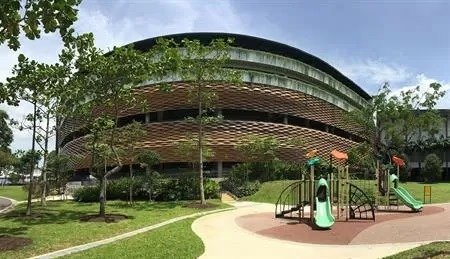
August 27, 2018 marked an important development in Singapore’s urban planning and real estate history when the Housing and Development Board launched a major government land site at Pasir Ris Central for public tender. The project was designed as more than a conventional residential development. It represented an integrated urban development concept that brought together housing, commercial activity, transport facilities and public services within a single connected location. The proposed development included private residential units along with commercial space, a bus interchange, a polyclinic and a town plaza. According to official information, the site had the potential to accommodate approximately 600 private residential units. The Pasir Ris Central project formed part of Singapore’s wider urban development strategy, which focuses on creating integrated and self sufficient communities rather than separating residential, commercial and public facilities into different areas. The development concept was designed to provide residents with greater access to transport, shopping, healthcare and other everyday services within the same urban centre. By combining multiple functions within one development, the project reflected Singapore’s approach to efficient land use and long term city planning. From a real estate perspective, the project provides an important example of the growing importance of mixed use developments in modern Asian cities. Integrating residential property, commercial activity and public infrastructure can improve the use of valuable urban land while potentially increasing the attractiveness of a location for residents, businesses and investors. The launch of the Pasir Ris Central site on August 27, 2018 therefore represents a significant moment in Singapore’s real estate and urban development history, demonstrating how government land planning can shape the future growth, accessibility and investment potential of an entire urban district.
Read More >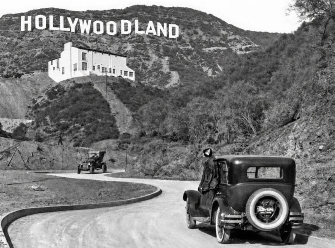
August 26, 1920 marks an important chapter in the real estate and urban development history of Los Angeles, as a major property promotion campaign helped create what would eventually become one of the most recognizable landmarks in the world. The famous Hollywood sign was originally created not as a symbol of the entertainment industry, but as an advertisement for a new residential development. The developers behind the Hollywoodland project placed a large illuminated sign on the hills overlooking Los Angeles to attract attention to the new housing development and encourage potential buyers to consider properties in the area. At the time, Los Angeles was expanding rapidly, with population growth driving demand for new residential communities. Developers were looking for innovative ways to promote properties and attract buyers to areas that were still being developed. The enormous hillside sign provided a highly visible form of advertising that could be seen across large parts of the city. The original sign read HOLLYWOODLAND, directly promoting the residential project. Although the sign was intended as a temporary marketing feature, it gradually became associated with the wider identity of the area. Over the following years, the final four letters were removed, leaving the now familiar HOLLYWOOD sign. Its identity eventually shifted from a real estate advertisement to a global symbol associated with Los Angeles, the American film industry and popular culture. The story remains a fascinating example in real estate history because a marketing tool created to sell homes ultimately became a landmark with worldwide recognition. For the modern property industry, the Hollywood sign also offers an enduring lesson about the power of place branding, visibility and real estate marketing. A successful property campaign can sometimes create an identity that becomes far more valuable and influential than the development it was originally designed to promote.
Read More >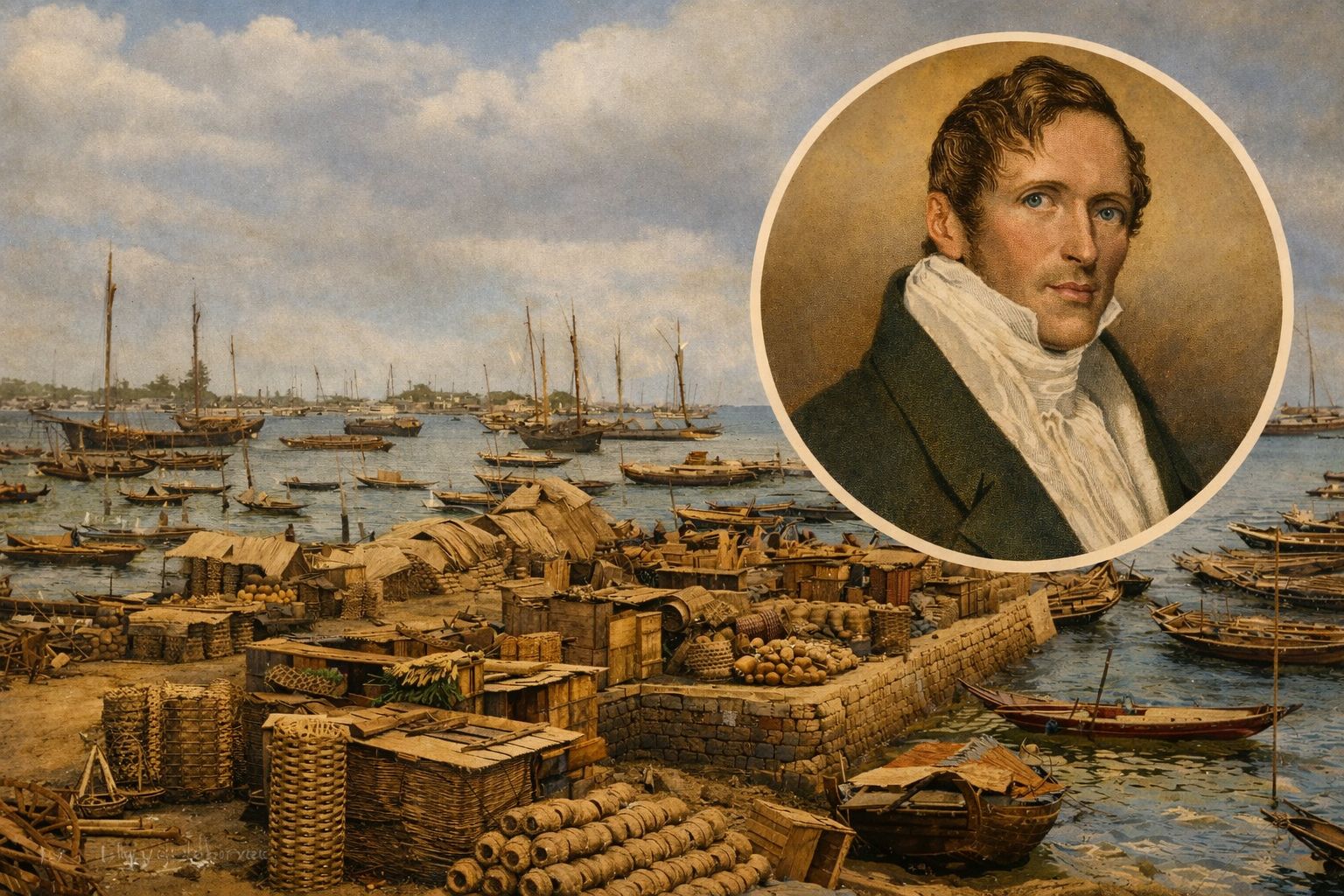
On 29 January 1819, a decision was taken that would quietly but decisively alter the course of maritime trade and urban development in Southeast Asia. On that day, Sir Stamford Raffles, a senior administrator of the British East India Company and then Lieutenant Governor of Bencoolen in Sumatra, arrived at an island that was scarcely more than a scattering of fishing settlements. That island would later become known to the world as Singapore. Raffles was not engaged in an act of conquest, nor was he founding a city in the conventional sense. His purpose was strategic. Britain sought to secure its commercial interests in the region and to counter the expanding Dutch dominance over regional trade routes. What Raffles undertook at Singapore was, in modern terms, an act of site selection grounded in geography rather than grand design. At the time of his arrival, Singapore was neither a recognised political entity nor an urban centre. The land fell loosely under the influence of the Sultanate of Johor, and there existed no formal system of land ownership as understood in European legal tradition. Authority over land was exercised through local custom and allegiance rather than written title or registry. [img:Images/otd-29-jan-2nd.jpeg | desc:These images document the transitional condition of Singapore in the period following Sir Stamford Raffles’ arrival and his selection of the site in 1819. The coastal scene shown is not simply a depiction of early port activity, but a visual record of the initial economic framework upon which Singapore’s later urban economy was constructed. The wooden vessels, temporary jetties, and shoreline warehouses indicate a space that remained informal in structure, yet was increasingly drawn into regional and international trading networks.The second image, portraying a colonial street lined with shophouses, illustrates the gradual transformation of a port settlement into an ordered urban landscape. When viewed together, these images demonstrate that Singapore’s development was not the result of sudden planning or abrupt intervention, but rather a cumulative process shaped by deliberate land selection, the steady growth of commerce, and the progressive formation of urban infrastructure. It was this measured and sustained evolution that ultimately enabled Singapore to emerge as a major global trading centre and a modern city of lasting historical significance.(Syed Shayan- Archive Head)] The decisive factor in Raffles’ choice lay in Singapore’s geographical position. Situated at the entrance to the Strait of Malacca, the island occupied one of the most critical maritime corridors in the world. For centuries, this narrow passage had carried the flow of trade between China, India, the Arab world, and Europe. To establish a port at this point was, in effect, to place a commercial foothold at the crossroads of global maritime traffic. Raffles understood that a secure and open port at such a location would draw ships not through coercion, but through convenience. Trade would follow geography, and settlement would follow trade. In this sense, the selection of Singapore was less an act of imperial ambition than a recognition of spatial inevitability. A formal treaty with the Sultan of Johor and the Temenggong was concluded on 6 February 1819, establishing British administration and granting Singapore the status of a free port. With this, land that had previously existed outside formal legal frameworks entered a new phase of regulated use, construction, and commercial development. From this single decision emerged a modest port, which gradually evolved into a town, then a city, and eventually a city state. In 1965, Singapore became an independent nation, its foundations still traceable to that initial act of land selection in 1819. Sir Stamford Raffles has since been remembered not merely as an administrator, but as the figure most closely associated with the island’s transformation. Today, the land once occupied by fishing communities stands among the most valuable and efficiently organised urban and commercial spaces in the world. Singapore ranks among the world’s wealthiest nations by income and economic output. Its port is counted among the busiest globally, commonly ranked second in container traffic, and functions as the world’s largest transshipment hub, a central node in the global shipping network where goods are redistributed across continents. In the history of urban development and real estate, 29 January 1819 endures as a reminder that the fate of cities is often shaped not by grand proclamations, but by the quiet precision of choosing the right place at the right moment.
Read More >