
Syed Shayan Real Estate Archive
Syed Shayan Real Estate Archive
From Real Estate History
3 Historical Event found
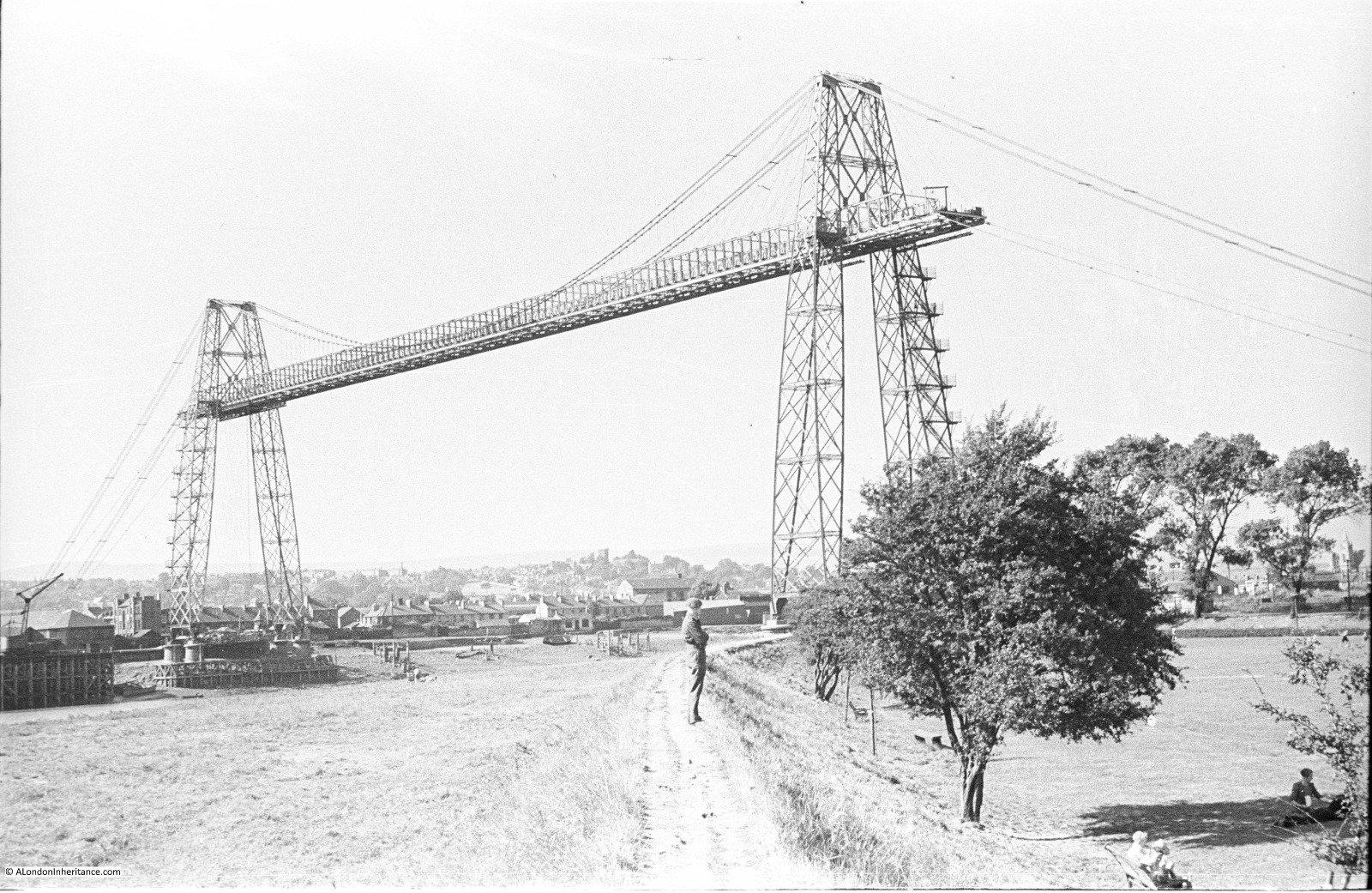
On September 12, 1906, the Newport Transporter Bridge was officially opened over the River Usk in south Wales. The unusual structure became an important part of Newport’s industrial development and remains one of the city’s best-known historic landmarks. The bridge was officially opened by Viscount Tredegar. The project was driven largely by the rapid expansion of industry on the eastern side of the River Usk. In 1896, industrialist John Lysaght announced plans for a steelworks on the eastern bank. Many of the workers lived on the western side of the river, while the existing crossing was inadequate for the growing workforce. Conventional bridges were considered impractical because of their cost, while the river also had to remain accessible to tall-masted ships travelling to wharves further upstream. Newport therefore adopted the innovative transporter-bridge concept developed by French engineer Ferdinand Arnodin. Newport Borough Engineer R. H. Haynes and Arnodin became joint engineers for the project. Parliamentary approval was secured in 1900, detailed plans were prepared in 1901 and construction began in 1902. After four years of work, the bridge opened on September 12, 1906, at a reported cost of about £98,000. Unlike a conventional bridge, the transporter bridge uses a high-level steel structure from which a movable gondola is suspended. The gondola carries people and vehicles across the river while allowing ships to pass beneath the main structure. According to the Welsh heritage record Cadw, the bridge has a clear span of approximately 196 metres and stands around 72 metres high. The bridge was therefore more than an engineering curiosity. It was a piece of infrastructure designed to support industrial growth, improve access to employment and connect communities on opposite sides of the river. Its story demonstrates how transportation infrastructure can influence the development of surrounding urban and industrial areas , a principle that remains central to modern real estate development. Today, the Newport Transporter Bridge is recognised as an important part of Newport’s industrial heritage and is a Grade I listed structure. The City of Newport describes it as one of the jewels of the city’s history and an important landmark in its future tourism strategy.
Read More >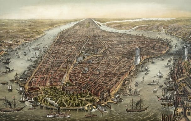
On 10 July 1690, authority in the Province of New York shifted firmly under the government established in the name of King William III and Queen Mary II during the aftermath of the Glorious Revolution. Although this was primarily a political event, it had lasting consequences for the future of land ownership, property administration, urban planning, and real estate development in what would become New York City. During the late seventeenth century, uncertainty over colonial authority had created confusion regarding land grants, property rights, taxation, and municipal governance. As the new administration consolidated control, the colony began restoring confidence in legal institutions responsible for managing land and property. This strengthened the framework through which deeds, land patents, municipal regulations, and property transactions could be recognized and enforced. The stabilization of government encouraged investment, trade, and settlement, helping New York evolve from a colonial port into one of the world's most valuable real estate markets. Over the following decades, clearer systems for recording land ownership, resolving property disputes, and administering real estate laid the institutional foundation for the city's long-term urban expansion. For historians of the built environment, this period represents an important milestone because stable governance and legally recognized property rights are essential prerequisites for organized urban growth. The institutions that emerged in the early 1690s ultimately contributed to the development of modern New York's real estate system, influencing land administration practices that continued for centuries.
Read More >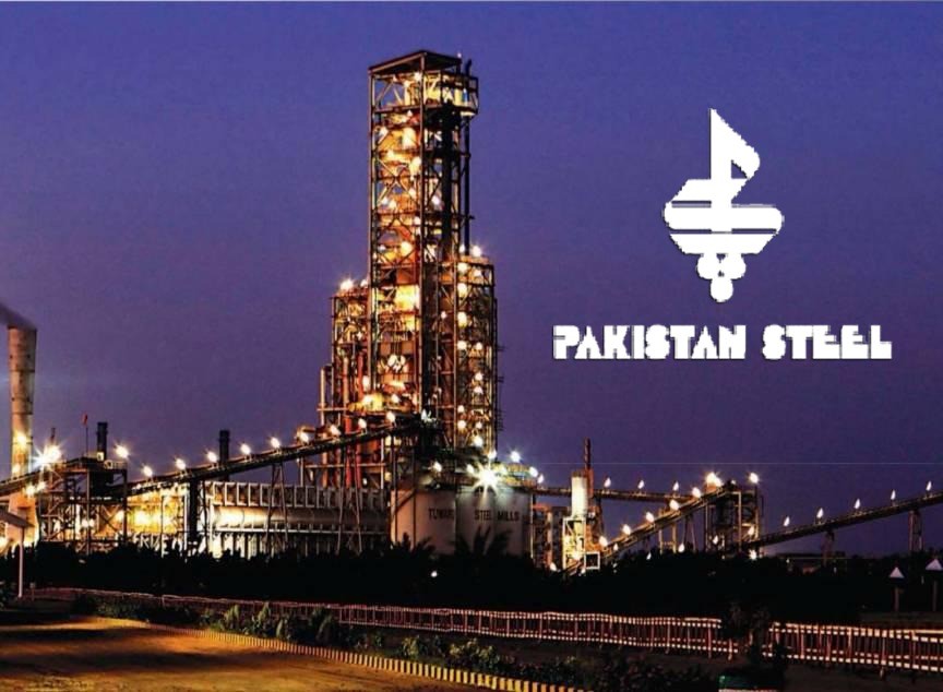
On 30 December 1973, a day of exceptional significance in the industrial and urban history of Pakistan, former Prime Minister Zulfikar Ali Bhutto laid the foundation stone of Pakistan Steel Mills at Bin Qasim, Steel Town, to the east of Karachi, beyond the then urban limits of the city. This project not only became a symbol of Pakistan’s industrial sovereignty but also led to an immediate and notable rise in land values across the surrounding areas of Karachi. Pakistan Steel Mills was established on approximately eighteen thousand six hundred acres of land near Karachi. Spread across such an extensive area, it was not merely an industrial unit but effectively a city within a city. The scale of this development can be understood by comparing it to Sukkur, the third largest city of Sindh, whose present urban area is approximately seventy five square kilometres. The land occupied by Pakistan Steel Mills was comparable to, and in some assessments larger than, the urban footprint of Sukkur. This vast expanse comprised the main industrial complex of the steel mills, the residential settlement of Steel Town, supporting infrastructure, roads, railway connections, and essential utilities. From a research perspective, it would not be inaccurate to describe Pakistan Steel Mills as one of the most prominent examples of large scale industrial land use undertaken by the state at that time. Its impact extended beyond industrial production to influence national patterns of urban expansion and land utilisation. As a result of this project, extensive coastal and semi agricultural land near Karachi was converted to industrial use. Over thousands of acres, the central steel complex, residential colonies, roads, utilities, and auxiliary infrastructure were developed, giving rise to a fully integrated industrial and urban zone in the Bin Qasim area. In parallel, Steel Town emerged as a planned residential city, designed specifically to accommodate industrial workers and government employees. From the perspective of real estate and urban development, the establishment of Pakistan Steel Mills triggered an extraordinary expansion of Karachi’s urban boundaries. Coastal and underdeveloped land underwent a fundamental transformation, land values increased significantly, and a new urban model emerged based on the interrelationship between port activity, industry, and residential settlement. This project became a defining example of large scale industrial land use by the state in Pakistan. From an archival standpoint, 30 December 1973 stands as the date that permanently reshaped the geographical, urban, and property landscape of Karachi’s eastern coastline. It is preserved as a milestone in the history of industrial real estate development in Pakistan.
Read More >