
Syed Shayan Real Estate Archive
Syed Shayan Real Estate Archive
From Real Estate History
12 Historical Event found

9 September 1987 is remembered as an extraordinary day in the history of global real estate. On that day, an experiment was carried out in Shenzhen, China, that would play an important role in transforming not only the Chinese property market in the years to come, but also the entire system of urban development and land management. What made the experiment particularly interesting was that the government did not sell ownership of the land to any private individual or company. Instead, ownership remained with the state while the right to use the land was transferred to an investor. According to research studies, on 9 September 1987, the right to use a plot of land measuring approximately 5,321.8 square meters in Shenzhen was transferred through negotiations to a local company at a rate of 200 yuan per square meter. At first glance, this decision appeared to be a limited administrative experiment. In reality, however, it raised a fundamental question about China’s land and real estate system: If land is owned by the state, can the right to use it be transferred through the market? At that time, state control over land in China was extremely strong. The idea of buying and selling land as an ordinary commercial commodity was entirely different from the modern real estate market. Shenzhen, which was then emerging as a major special economic zone for experimenting with reform and opening up, was searching for new financial resources to support rapid development. As a result, the concept of separating land ownership from the right to use it emerged. This became the key point that later played an important role in laying the foundation for China’s modern land system. But the story did not end there. Just a few months after the 9 September experiment, on 1 December 1987, Shenzhen held the first formal public land auction in Chinese history. The Shenzhen government openly auctioned the right to use the land and granted it to an investor through competitive bidding. According to Shenzhen’s official history, this auction proved to be a decisive moment in reforming China’s land management system. This first experiment gradually helped create a system in which actual ownership of the land could remain with the state, while the rights to use it could be transferred through the market for fixed periods. In the years that followed, this concept became a fundamental part of China’s urban real estate system. According to research sources, different terms were later established for urban land-use rights, including 70 years for residential use, 50 years for industrial use, and 40 years for commercial use. This change was not merely legal or administrative in nature. It also affected the construction of Chinese cities, government revenue, infrastructure development, and the real estate market. The transfer of land-use rights made urban land part of economic activity and gave governments the opportunity to use land as a financial resource for urban development. To give this experiment legal status, changes were later made to China’s Constitution as well. On 12 April 1988, Article 10 of the Constitution was amended to allow for the transfer of land-use rights. After that, the Shenzhen experiment gradually became part of a broader national system. Today, when the world looks at China’s towering cities, large housing projects, commercial districts, and multibillion-dollar property market, very few people may remember this small historical experiment. But 9 September 1987 is extraordinary in the history of real estate because, on that day, a question was put into practice that would later transform the land system of an entire country: Can land remain state-owned while the right to use it is bought and sold in the market—is this possible? Shenzhen provided a practical answer to that question, and this experiment later became one of the important foundations of China’s modern real estate system.
Read More >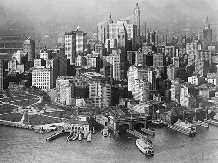
On September 2, 1922, New York’s real estate market was already showing signs of a transformation that would reshape parts of Manhattan. The Real Estate Record and Builders’ Guide, one of the era’s important property and construction publications, devoted a major feature to renewed activity along Third Avenue, describing a wave of buying, redevelopment and modernization that was changing one of Manhattan’s oldest north-south commercial thoroughfares. The report is particularly significant because it captured the real-estate market at a moment when old buildings were increasingly being viewed not simply as ageing properties, but as redevelopment opportunities. Third Avenue, stretching from the Bowery and Cooper Square toward the Harlem River, had experienced substantial property activity during the preceding six months. According to the publication, purchases were being made by both professional operators and investors, while merchants themselves were becoming increasingly important participants in the market. From Old Tenements to Modern Property Third Avenue had a long history as a transportation and commercial corridor. The publication noted that the avenue had once been associated with early horse-car transportation and later with one of New York’s pioneering elevated railway routes. Its surrounding neighbourhoods were densely populated, creating a strong customer base for local retailers. But much of the property stock remained old. Three- and four-storey tenement buildings with ground-floor shops dominated large sections of the avenue. Many had been constructed decades earlier and lacked the modern storefronts and facilities increasingly demanded by businesses and consumers. The 1922 report argued that these outdated buildings had contributed to declining property values. Yet it also identified an opportunity: modernization could restore and potentially increase the value of the land and buildings. The emerging redevelopment cycle was unusual because existing shopkeepers were helping drive it. Merchants who feared rising rents elsewhere increasingly chose to purchase the buildings in which their businesses operated. Their purchases attracted professional real-estate operators, who began acquiring older properties from long-established owners, renovating them and selling or leasing them to businesses and investors. Transit, Commerce and Rising Property Values Transportation was another major factor behind the revival. The report highlighted the importance of the rapid-transit route running through nearby Lexington Avenue, effectively giving Third Avenue access to another major transportation corridor. The changing commercial environment was also visible on the street. Restaurants were replacing some saloons, while specialty shops, book stores, furniture retailers, jewellers, florists, druggists and other businesses were expanding their presence. Longer commercial leases were becoming increasingly common. One notable example cited by the publication involved United Cigar Stores, which leased old buildings at Third Avenue and East 86th Street for 21 years, with a renewal option. The aggregate rental was reported at approximately $500,000 net, while the site was expected to receive a modern business building. The report connected the property revival to wider post-World War I economic conditions. Construction costs had risen sharply, making existing buildings comparatively valuable. At the same time, merchants seeking affordable commercial locations were increasingly attracted to Third Avenue. The September 2, 1922 record therefore offers more than a snapshot of an old New York property market. It documents a familiar real-estate phenomenon: ageing buildings, changing transportation patterns, rising commercial demand and redevelopment combining to transform an established urban corridor. More than a century later, the account remains a remarkable historical example of how property values can be reshaped when infrastructure, commerce, investment and redevelopment converge.
Read More >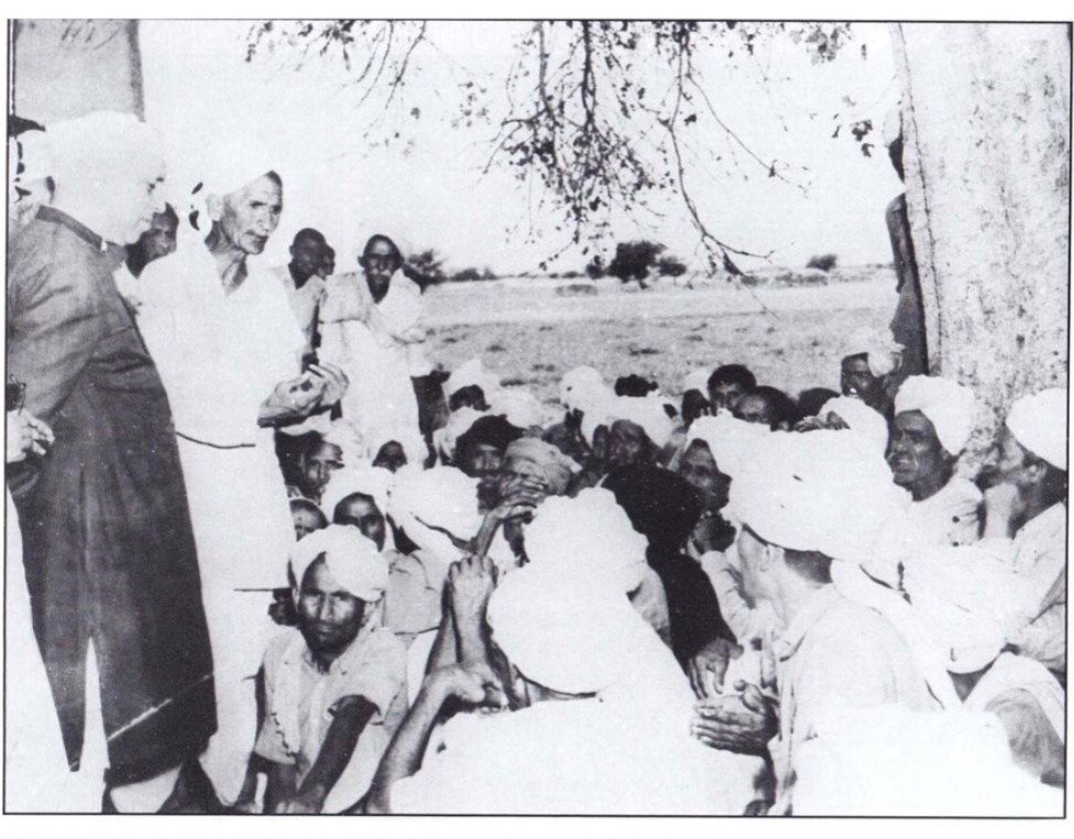
August 30, 1957, marked an important moment in the history of urban development and housing in New Delhi, when around 1,000 farmers from villages on the outskirts of the capital protested against the acquisition of their land for a government housing scheme and the construction of a major medical institution. The farmers came to meet Prime Minister Jawaharlal Nehru, raising concerns about the loss of their agricultural land to expanding urban development. At the time, New Delhi was expanding rapidly, and the growth of the capital was placing increasing pressure on surrounding agricultural areas. The farmers feared that their land could ultimately be transferred to wealthy companies or housing societies, which could acquire land at relatively low prices and later sell it at substantially higher values. Nehru acknowledged these concerns and expressed his disapproval of cases in which housing companies had purchased land cheaply and made large profits by selling it at much higher prices. The broader issue was how Delhi should accommodate its growing population without allowing uncontrolled development to overwhelm surrounding communities. Nehru argued that the expansion of a major city could not simply be stopped. However, he stressed that urban growth could take place either through proper planning or in a haphazard manner. In his view, uncontrolled expansion would particularly hurt farmers living around the city, who could be pressured into selling fragmented parcels of land without adequate arrangements for their future housing and livelihoods. Nehru therefore advocated a more organized approach to Delhi’s expansion, one that would take into account both the requirements of urban development and the interests of the affected rural population. He did not announce an immediate final decision on the land acquisition issue, but promised to examine what was being proposed and how the interests of the farmers could be protected. The episode is significant in real estate and urban development history because it brought together several issues that remain central to modern cities: land acquisition, housing development, urban expansion, agricultural land conversion and the protection of local communities. The events of August 30, 1957, therefore offer an early example of a debate that continues across rapidly growing cities today: how can urban development expand while ensuring that the people whose land makes that expansion possible are not left behind?
Read More >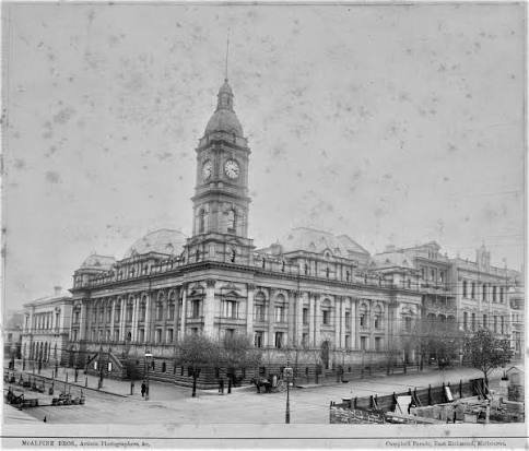
Melbourne celebrated the opening of its new Town Hall with a grand fancy dress ball, marking a memorable moment in the history of a building that would become one of the city’s most important civic and architectural landmarks. The new Melbourne Town Hall emerged at a time of rapid urban growth following Victoria’s gold rush. Melbourne’s earlier town hall had become inadequate for the expanding city, creating demand for a larger and more imposing civic headquarters. A design competition for the new building was won by the prominent architectural firm Reed and Barnes. The foundation stone was laid on November 29, 1867, by Prince Alfred, Duke of Edinburgh. Constructed using bluestone and Tasmanian freestone, the building incorporated municipal offices, council chambers, mayoral rooms, a large public auditorium and a prominent clock tower. The building was formally opened on August 9, 1870. Two days later, on August 11, Mayor Samuel Amess hosted an elaborate fancy dress ball at his own expense to celebrate its opening. The original invitation to the event survives in the City of Melbourne Art and Heritage Collection, providing a direct historical record of the occasion. Over the decades, Melbourne Town Hall developed into far more than an administrative building. It became a focal point for political meetings, public debate, civic ceremonies and cultural events. Important gatherings connected with the movement toward Australian Federation were later held within its walls. The building also evolved physically with Melbourne itself. A major fire in 1925 destroyed much of the main auditorium and its organ, leading to reconstruction and enlargement of the complex. Later additions expanded its administrative role while retaining the architectural character of the original civic landmark. Today, Melbourne Town Hall remains heritage listed and continues to stand at the centre of the city’s civic and cultural life. The celebrations of August 11, 1870 therefore marked more than the arrival of a new building; they symbolised Melbourne’s transformation into a growing, confident and increasingly sophisticated urban centre.
Read More >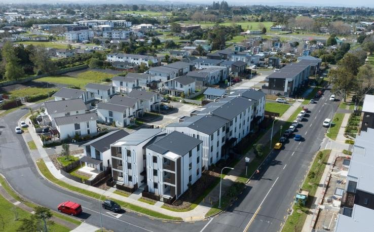
New Zealand’s Urban Development Act 2020 came into force, introducing a new legal framework for undertaking complex housing and city development projects across the country. The Act received royal assent on 6 August and became effective the following day. It significantly expanded the urban development role of Kāinga Ora, the government agency responsible for public housing and community development. At the time, New Zealand’s major cities were facing growing pressure from housing shortages, rising property prices, fragmented land ownership and infrastructure constraints. Large developments often struggled to proceed because planning decisions, transport networks, utilities, land acquisition and financing were managed through separate systems. The legislation sought to address those barriers by creating the Specified Development Project process. Under this framework, Kāinga Ora could work with local councils, Māori land interests, communities and private developers to plan and deliver major urban projects. For approved projects, the agency gained access to powers covering planning rules, resource consents, infrastructure construction, land assembly and development funding. It could help combine separately owned parcels of land, alter the classification of public reserves, coordinate roads and utilities, and use targeted charges to support infrastructure. The government said the objective was not simply to construct more buildings, but to create complete communities containing state housing, affordable homes and market priced properties alongside transport connections, employment opportunities, parks and community facilities. Because the law provided extensive development and land acquisition powers, it also included consultation requirements and protections for environmental, cultural and heritage interests. Special safeguards applied to Māori customary land, reserves and land connected with Treaty settlements. The Act marked an important shift in New Zealand’s approach to real estate development. Rather than treating housing, infrastructure and land planning as separate challenges, it brought them within a coordinated urban development framework. Its introduction reflected a broader lesson for rapidly growing cities: increasing housing supply often requires more than approving individual construction projects. Governments may also need coordinated land policies, infrastructure investment and long term planning capable of creating functioning neighbourhoods rather than isolated housing schemes.
Read More >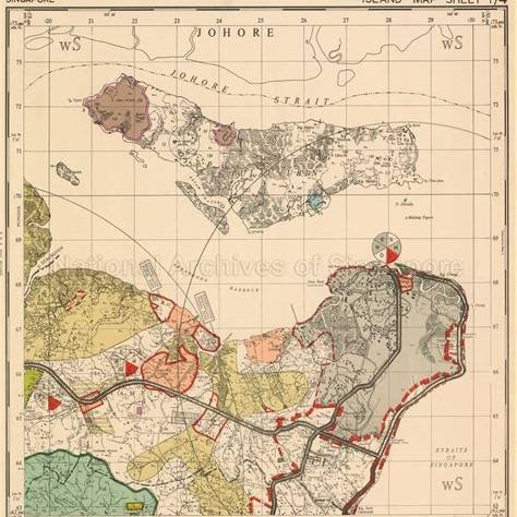
The Governor in Council approved Singapore’s first statutory Master Plan, marking an important turning point in the history of the island’s land use, housing and property development. The approval created a formal planning framework through which the future use of land and buildings across Singapore could be regulated and coordinated. The plan was based on a diagnostic survey that began in January 1952, while its draft was submitted for consideration in late 1955. Following several years of surveys, consultations and planning work, the final document was approved in August 1958. The approval notice was gazetted on 8 August, when the plan formally came into operation. The Master Plan consisted of 53 coloured maps covering different parts of Singapore, supported by a detailed Written Statement. Together, these documents showed how the government proposed that land and buildings should be used in the future. Residential areas, commercial centres, industrial land, roads, public facilities and recreational spaces could now be viewed as parts of one coordinated urban system rather than as isolated development projects. For the property sector, the plan introduced greater order and certainty. Developers, landowners and government agencies could assess proposed construction and changes in land use against an officially approved blueprint. It also allowed planning authorities to guide development density and reserve land for housing, transport, industry and community needs. The 1958 Master Plan was prepared during a period when Singapore faced serious overcrowding, inadequate housing, traffic congestion and pressure on urban land. Although later population growth, industrialisation and the expansion of public housing required broader planning strategies, the plan established the legal and administrative foundations of modern development control. Singapore subsequently adopted the 1971 Concept Plan and continued reviewing its Master Plan regularly. Today, the Master Plan remains the country’s statutory land use document, guiding the development of land and property over the medium term. The approval of 5 August 1958 therefore represented more than the publication of a set of maps. It marked Singapore’s transition towards systematic urban planning and laid an early foundation for its transformation into one of Asia’s most carefully planned property and urban development markets.
Read More >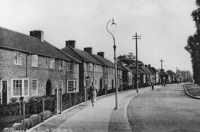
Britain’s Housing Act 1935 received Royal Assent, moving national policy on urban housing, overcrowding and neighbourhood redevelopment into a new phase. The legislation emerged at a time when many families in London and other industrial cities were living in small dwellings with inadequate space, poor facilities and unhealthy conditions. Parliamentary records confirm that the Act received Royal Assent on that date, while its stated purposes included preventing overcrowding, supporting the redevelopment of urban areas and encouraging the reconditioning of existing buildings. Its most important contribution was the introduction of a statutory national method for deciding when a dwelling was overcrowded. The assessment considered the number and size of rooms, the number and ages of occupants and, in certain circumstances, the need for separate sleeping accommodation for males and females. Overcrowding had long been recognised as a serious social and public health problem, but authorities had lacked one clear and enforceable definition. During the parliamentary debate, the proposed standard was described as a landmark because it gave local housing authorities a common yardstick for measuring the problem. The Act also required local authorities to examine housing conditions in their districts, identify overcrowded homes and prepare schemes for providing suitable alternative accommodation. Its scope extended beyond occupancy levels. It contained provisions connected with urban redevelopment, the improvement of deteriorating buildings, housing advisory arrangements and the management of homes controlled by local authorities. In this way, housing was increasingly treated not simply as a question of private property, but as an issue involving public health, municipal planning and government responsibility. The influence of the legislation continued well beyond the 1930s. The House of Commons Library notes that the statutory overcrowding standard introduced in 1935 was not substantially updated afterwards and that its principles remain reflected in later housing law. Although the original standard has since been criticised as inadequate for modern living conditions, its creation represented an important shift toward measurable housing rights and planned public intervention. The events of August 2, 1935 therefore remain significant in global real estate and urban history. They show that successful urban development is not measured only by the number or value of buildings constructed. It also depends on whether homes provide sufficient space, safety, dignity and a healthy environment for the people who occupy them.
Read More >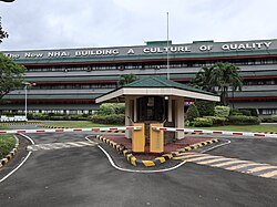
The Philippines created the National Housing Authority through Presidential Decree No. 757. The decision brought major government housing, residential development and resettlement responsibilities under one national institution. Several existing housing agencies were dissolved, with their powers, assets and programmes transferred to the newly established authority. During the 1970s, the Philippines, particularly Metropolitan Manila, was experiencing rapid urban population growth, migration from rural areas and a serious shortage of adequate homes for families with limited incomes. The decree acknowledged that the scale of the housing problem required an organised mass housing programme rather than a collection of separate and limited projects. The National Housing Authority was directed to develop a comprehensive and integrated housing programme. Its responsibilities included housing construction, settlement development, relocation projects, land acquisition and cooperation with public and private organisations. The programme was also expected to address housing finance, urban land management, economical construction methods and the different needs of Filipino households. The authority received the power to acquire public or privately owned land for approved housing purposes. It could develop projects independently or through joint arrangements with other government bodies and private companies. It was also authorised to issue bonds and use other financial instruments to fund housing programmes. This mandate meant that the authority was responsible for more than the physical construction of houses. Its work involved land preparation, infrastructure, financing, relocation and the broader development of communities. In later years, the agency became an important part of government responses to informal settlements, public development projects and housing needs following natural disasters. Its projects also faced continuing challenges, including limited funding, expensive urban land, distant relocation sites and inadequate access to jobs, transport and public services. These difficulties demonstrated that providing a house alone does not necessarily create a successful residential community. The establishment of the authority on July 31, 1975, therefore remains an important event in Asian housing history. It represented an attempt to treat housing, land, urban planning, infrastructure and resettlement as connected parts of a national development policy.
Read More >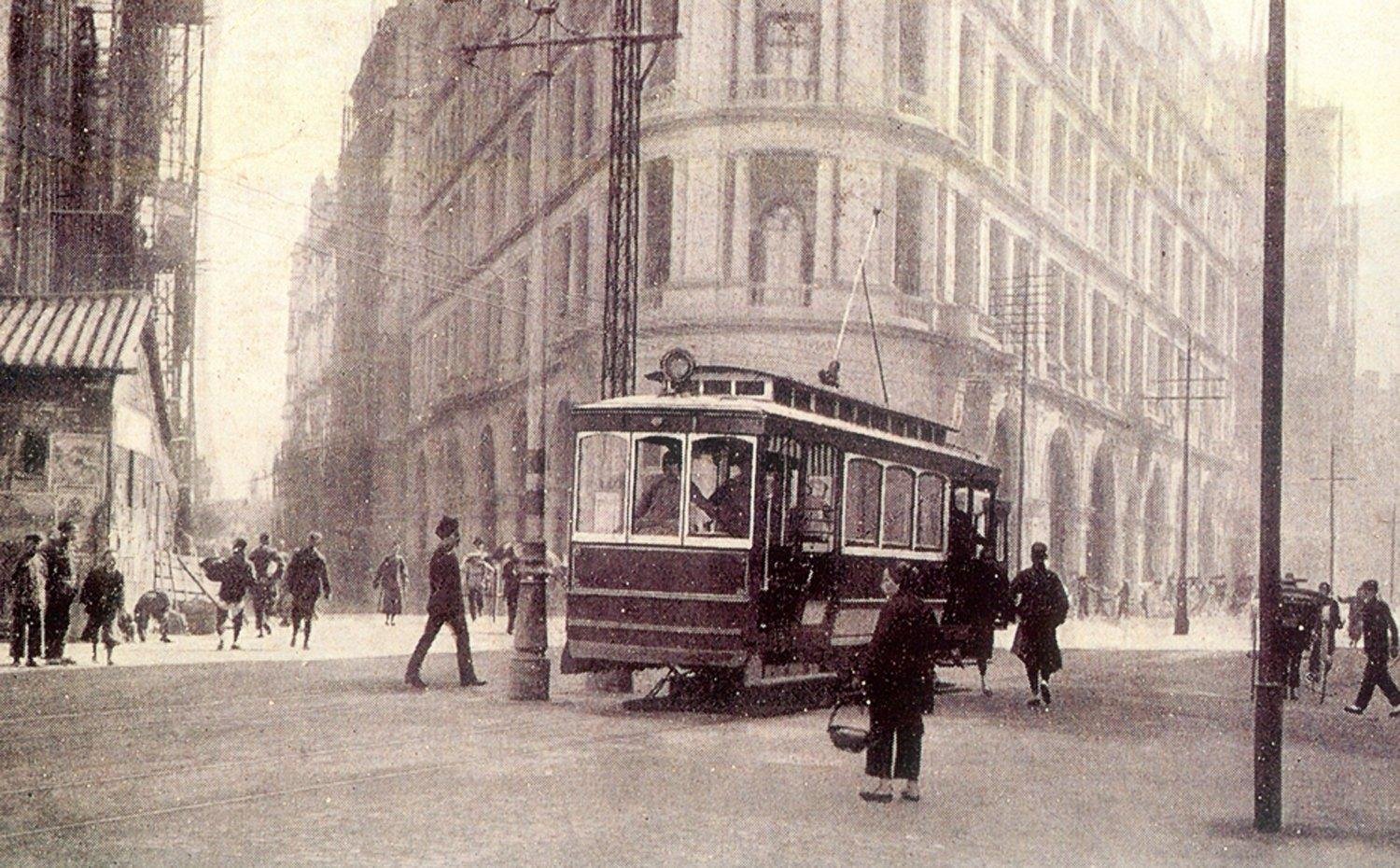
Hong Kong’s first electric tram began operating, marking an important moment in the history of the city’s transport system, urban planning and property development. The original fleet consisted of 26 single deck tramcars, while the first route connected Kennedy Town with Causeway Bay. The line was later extended eastwards to Shau Kei Wan. The tram travelled along the northern side of Hong Kong Island, where the harbour, government offices, markets, business districts and residential communities were expanding. Before the service began, travel between different parts of the city depended on slower and less predictable forms of transport. The tram introduced a more affordable, regular and reliable way for residents to move between their homes and workplaces. From a real estate perspective, improved accessibility was one of the most significant effects of the new system. Land and buildings located near the tram route became more useful for housing, retail and commercial activity. Workers could live farther from the central business areas while continuing to travel conveniently each day. Businesses located near tram stops also benefited from increased pedestrian movement and a larger flow of potential customers. Shops, offices and services were encouraged to concentrate along the transport corridor, helping create active commercial streets and more densely developed neighbourhoods. As Hong Kong continued to grow, areas connected by the tram attracted additional residential buildings, markets and community facilities. Public transport therefore did more than respond to existing demand. It helped determine where future development would take place and how different parts of the city would be connected. The original single deck vehicles were later replaced by the double deck trams that became one of Hong Kong’s most recognisable urban features. Known locally as “Ding Ding” because of the sound of their bells, the trams remained closely associated with the city’s identity and everyday life for more than a century. The opening of the tramway on July 30, 1904, demonstrates a lasting principle of real estate development: dependable public transport can increase accessibility, strengthen property demand, support commercial growth and influence the long term pattern of urban expansion.
Read More >
On July 29, 1836, the Arc de Triomphe was officially inaugurated in Paris after nearly 30 years of construction. The monumental structure later became one of the most recognisable architectural and urban landmarks in the French capital. The project was initiated in 1806 during the rule of Napoleon Bonaparte. It was planned at the western end of the Champs Élysées so that the monument could be clearly seen from important royal and public routes across the city. It now stands at the centre of the former Place de l'Étoile, presently known as Place Charles de Gaulle. Construction was interrupted several times because of political change, changes of government and administrative difficulties. Despite these delays, the structure was eventually completed and inaugurated on July 29. According to the official history of the monument, a major public celebration was cancelled because of security concerns and only a small number of officials attended the ceremony. In the history of real estate and urban development, the Arc de Triomphe demonstrates how a major public structure can become a permanent part of a city's identity, street layout, tourism economy and surrounding built environment. It remains a central feature of the Paris cityscape and an internationally recognised symbol of French architecture.
Read More >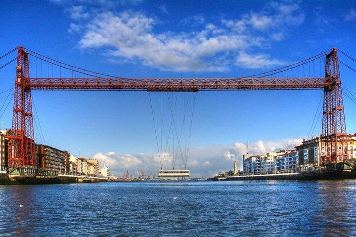
The Vizcaya Bridge opened to the public in northern Spain. Recognised as the world’s first transporter bridge, it introduced a new approach to bridge construction, urban connectivity and movement between growing industrial communities. Located near Bilbao, the bridge connects the urban areas of Portugalete and Getxo across the estuary. Instead of carrying ordinary road traffic directly across its upper structure, the bridge uses a suspended platform known as a gondola to transport passengers and vehicles between the two riverbanks. The high steel structure allowed large ships to continue passing beneath it. This was particularly important for the port and industrial economy of the Bilbao area, where uninterrupted river traffic was essential. The bridge was designed by Basque architect Alberto de Palacio. Its combination of iron construction, steel cables and a suspended transporter mechanism created an influential new engineering design. Similar transporter bridges were later constructed in other parts of the world. The bridge stopped operating between 1937 and 1941 after suffering damage during the Spanish Civil War. It was later restored, while further conservation work strengthened damaged structural elements and introduced modern safety systems. UNESCO added the Vizcaya Bridge to the World Heritage List in 2006, and it remains operational. From a real estate and urban planning perspective, the bridge shows that a city does not grow through buildings alone. Reliable transport connections can bring residential, commercial and industrial districts closer together, improve access to land and support more effective urban development.
Read More >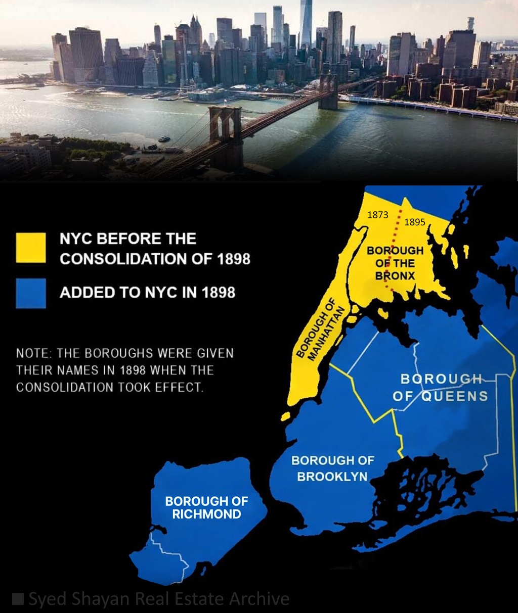
On 1 January 1898, New York City assumed its modern form in an event historically known as Greater New York. On this date, Manhattan, the Bronx, Brooklyn, Queens and Staten Island were consolidated into a single urban entity. Prior to this union, Brooklyn was an independent city and, by population, the fourth largest city in the United States, while Queens and Staten Island were largely agricultural, semi rural areas with separate administrative identities. The Bronx functioned under a distinct county structure, and Manhattan faced intense population pressure within a limited geographical space. From a real estate perspective, this decision of consolidation carried exceptional significance. After 1898, Manhattan, already the most expensive district, entered a phase of vertical development centred on the Financial District and Midtown, while Brooklyn and Queens emerged for the first time as large scale residential zones. Staten Island became closely linked to port related and logistical activities, while the Bronx developed as an industrial centre and later as a hub of middle class housing. It was at this stage that modern zoning concepts took root in New York, subsequently shaping the structured division of urban land into residential, commercial and industrial uses. The modern concept of urban transport also emerged from this period with the opening of the New York City subway in 1904. A coordinated underground railway network enabled extensive housing development across Queens, Brooklyn and the Bronx. The geographical continuity and spatial expansion evident in New York’s real estate values today can be traced directly to this formative era. Historically, the impact of this consolidation on real estate was profound. For the first time, a true mega city came into existence in which the port, industry, financial institutions, housing and transport were integrated within a single urban system. The long term appreciation of land values was a direct outcome of this decision, while the systematic growth of zoning practices, the subway network and commercial scale development only became possible after 1 January 1898. As a result, New York came to rank among the cities with the most expensive real estate markets in the world. The annexation of New York with surrounding areas, known in historical terminology as boroughs, is regarded as one of the earliest models of the modern mega city. London, Paris, Tokyo and other global cities later adopted similar models, each shaped by its own historical and administrative context. It is also important to clarify that the name New York did not originate after the consolidation of 1898. The name had existed for nearly two centuries prior. The city was named New York in 1664 when the British Empire seized the Dutch settlement of New Amsterdam and renamed it in honour of the Duke of York. The change introduced in 1898 was not one of nomenclature but of urban structure, a transformation historically defined as Greater New York.
Read More >