
Syed Shayan Real Estate Archive
Syed Shayan Real Estate Archive
From Real Estate History
In October 1939, as the clouds of the Second World War gathered over the Indian subcontinent, Lahore stood as the administrative and military heart of British Punjab, a thriving center of commerce, governance, and mobility. During this critical moment, the Punjab Government declared Lahore a War Time Urban Zone and instructed the Lahore Improvement Trust (LIT) to begin urgent urban replanning to meet the city’s growing strategic and civilian needs.
According to the Punjab Government Gazette issued on October 11, 1939, the LIT was directed to prepare a comprehensive plan that included new zoning, housing schemes, road expansions, and modern drainage systems for the city’s southern and western areas, particularly around Ferozepur Road, Mozang, Ichhra, and the outskirts of Model Town.
This initiative marked the beginning of modern urban planning in Lahore. It introduced, for the first time, the concept of planned urban expansion, a model that would later shape the development of Shadman, Garden Town, Muslim Town, and Gulberg.
The wartime replanning reflected a blend of British civic order, canal-based land use, and emerging defense corridors. It redirected the city’s axis of growth from the old walled core toward the south and west. It was also the first time a formal boundary was drawn between the city and the district, a line that would define Lahore’s urban identity for generations to come.
▪ Reference(s):
اکتوبر 1939 میں جب دوسری عالمی جنگ کے بادل برصغیر پر چھا گئے، لاہور برطانوی پنجاب کا نہ صرف انتظامی مرکز تھا بلکہ فوجی و تجارتی سرگرمیوں کا بھی اہم گڑھ تھا۔ انہی دنوں پنجاب حکومت نے لاہور کو “War-Time Urban Zone” قرار دیتے ہوئے لاہور امپرومنٹ ٹرسٹ (LIT) کو ہنگامی بنیادوں پر شہری ازسرِنو منصوبہ بندی (Replanning) کی ہدایت دی۔
11 اکتوبر 1939 کے پنجاب گورنمنٹ گزٹ کے مطابق، LIT کو حکم دیا گیا کہ وہ فیروزپور روڈ، مزنگ، اچھرہ، اور ماڈل ٹاؤن کے درمیانی علاقوں کے لیے نئی زوننگ، رہائشی اسکیمیں، سڑکوں کی توسیع، اور نکاسی آب کا ایک جامع منصوبہ تیار کرے۔
یہ وہ لمحہ تھا جس نے لاہور کو جدید شہری منصوبہ بندی کے دور میں داخل کیا اور پہلی بار “منصوبہ بند شہری توسیع (Planned Urban Expansion)” کا تصور متعارف کرایا — ایک ایسا ماڈل جو بعد میں شادمان، گارڈن ٹاؤن، مسلم ٹاؤن، اور گلبرگ جیسے علاقوں کی بنیاد بنا۔
یہ Replanning دراصل برطانوی دور کے شہری نظم، نہری زمینوں کے استعمال، اور دفاعی راہداریوں کے امتزاج کا مظہر تھی، جس نے لاہور کی سمت اندرونِ شہر سے جنوب اور مغرب کی جانب موڑ دی۔ یہی وہ عہد تھا جب پہلی بار “شہر” اور “ضلع” کے درمیان ترقیاتی لکیر کھینچی گئی — ایک لکیر جو بعد میں لاہور کی شہری شناخت کی اساس بنی۔
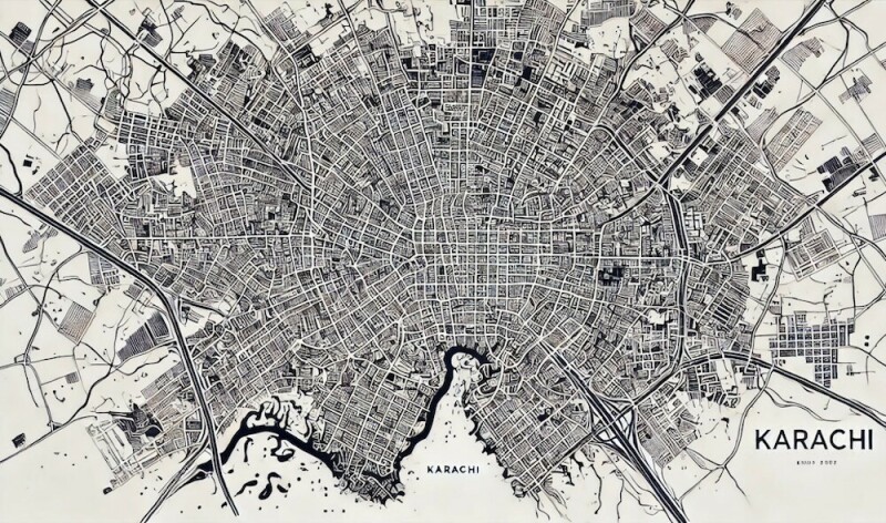
On October 11, 1955, the Federal Cabinet of Pakistan approved the formation of the Karachi Development Authority (KDA) Master Plan Unit, marking the beginning of the country’s first metropolitan level planning institution. This landmark decision came during a period of rapid urban growth as Karachi evolved into the economic and administrative center of the newly independent state.
By the mid 1950s, Karachi’s population had more than doubled since 1947 due to large scale migration, industrial expansion, and the relocation of government institutions. The city’s unplanned expansion created increasing challenges in housing, transportation, sanitation, and water supply. Recognizing the urgency of these issues, the Federal Cabinet directed the Ministry of Housing and Works to establish the Karachi Master Plan Commission, supported by the United Nations Technical Assistance Board (UNTAB).
The Commission was given the responsibility to prepare a twenty year comprehensive plan to guide Karachi’s spatial development, zoning, housing programs, and industrial growth. The Karachi Development Authority was created as the executive body to implement this plan and to coordinate future infrastructure projects. The Master Plan Unit became the core of this initiative and set a model for urban management across Pakistan.
The KDA’s vision described Karachi as a balanced coastal metropolis emphasizing organized residential clusters, industrial corridors, and modern transport systems. This vision provided the foundation for the development of satellite towns such as Korangi, Landhi, Malir, and New Karachi, designed to decentralize population and economic activity from the congested city center.
The 1955 decision transformed Karachi into South Asia’s first major postcolonial experiment in organized urban growth. It marked a shift from colonial style municipal administration to a structured institutional framework for metropolitan planning supported by both national expertise and international technical collaboration.
▪ Reference(s):
کراچی: وفاقی کابینہ نے آج کراچی ڈیولپمنٹ اتھارٹی (KDA) کے تحت ماسٹر پلان یونٹ کے قیام کی منظوری دے دی ہے۔
یہ ملک کی پہلی باقاعدہ میٹروپولیٹن منصوبہ ساز اتھارٹی ہے جو شہر کے لیے ایک جامع شہری ترقیاتی منصوبہ تیار کرے گی۔
وزارتِ ہاؤسنگ اینڈ ورکس نے اقوامِ متحدہ کے ٹیکنیکل اسسٹنس بورڈ (UNTAB) کے اشتراک سے کراچی ماسٹر پلان کمیشن تشکیل دے دیا ہے۔
کمیشن کو ہدایت دی گئی ہے کہ وہ شہر کی زوننگ، رہائشی اسکیموں، صنعتی علاقوں، اور بنیادی ڈھانچے کے لیے بیس سالہ ماسٹر پلان تیار کرے۔
آبادی میں تیزی سے اضافے، صنعتوں کے پھیلاؤ، اور سرکاری دفاتر کی منتقلی کے باعث کراچی کو پانی، صفائی، اور ٹرانسپورٹ کے سنگین مسائل کا سامنا ہے۔
نیا کمیشن ان مسائل کے حل کے لیے جامع خاکہ تیار کر رہا ہے تاکہ شہری سہولتوں میں بہتری لائی جا سکے۔
KDA کے مطابق کراچی کو ایک منظم ساحلی شہر کے طور پر ڈھالنے کا منصوبہ تیار کیا جا رہا ہے۔
رہائشی بلاکس اور صنعتی زونز کے ساتھ کورنگی، لانڈھی، ملیر اور نیا کراچی جیسے نئے سیٹلائٹ ٹاؤنز کی تعمیر کا کام بھی منصوبے میں شامل ہے تاکہ آبادی کا دباؤ مرکزی شہر سے کم کیا جا سکے۔
یہ پاکستان کے شہری ترقیاتی سفر میں ایک سنگِ میل سمجھا جا رہا ہے۔
ماہرین کا کہنا ہے کہ یہ منصوبہ کراچی کو ایک متوازن، خود کفیل اور جدید شہر میں بدلنے کی بنیاد فراہم کرے گا۔
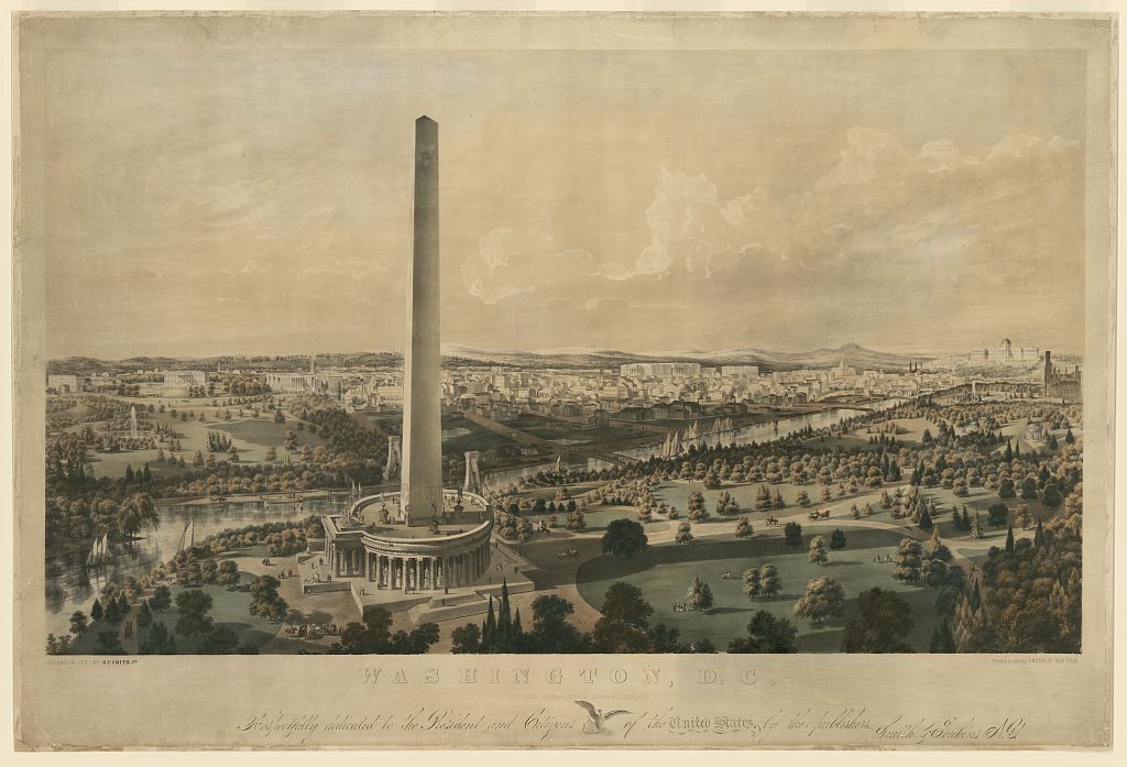
On October 9, 1888, the Washington Monument in Washington D.C. was officially opened to the public. Standing 555 feet tall, it was the tallest man-made structure in the world until the completion of the Eiffel Tower in 1889. Its construction, delayed for decades due to funding issues and the American Civil War, became a lasting symbol of civic visi...
Read More →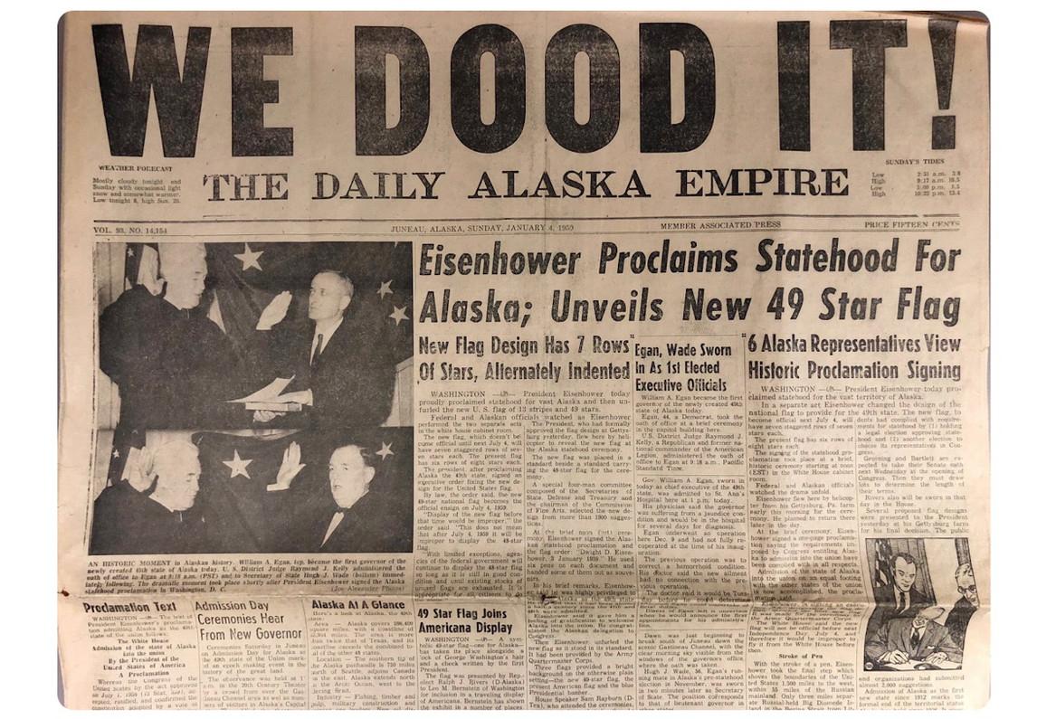
3 January 1959 marks not merely the admission of Alaska as the forty ninth state of the United States, but a historically significant moment representing the transfer of ownership of one of the largest landmasses in modern history. Prior to attaining statehood, Alaska formed part of the Russian Empire and was known as Russian America. Russian expl...
Read More →
On November 24, 1963, newly sworn-in U.S. President Lyndon B. Johnson addressed the United Nations for the first time following the assassination of President John F. Kennedy. The global community watched closely as Johnson outlined America’s commitments to international cooperation, nuclear arms control, and ongoing development programs under th...
Read More →.webp)
On October 16, 2008, the bankruptcy of Lehman Brothers triggered a historic collapse in global real estate markets. The bank’s failure, caused by excessive exposure to subprime mortgages, led property prices to drop by 30–50% across major cities worldwide. Mortgage lending froze, construction projects halted, and millions of homeowners faced fo...
Read More →
In Britain, the understanding of land and property ownership underwent a decisive and lasting transformation with the legal enforcement of the Land Registration Rules 1925 under Statutory Instrument 1925 No. 1093. According to the records of the House of Lords and official legal archives, the final confirmation of these Rules on 5 December 1925 ...
Read More →
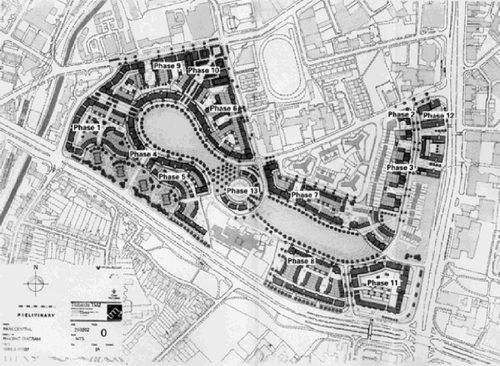
The acquisition of land for the Model Town Society was one of the most remarkable and spirited chapters in its early history. Dewan Khem Chand and his...

Between 1921 and 1924, the land for Model Town Lahore was acquired in successive phases. The process began in 1921, shortly after the establishment of...
No comments yet. Be the first to comment!