
Syed Shayan Real Estate Archive
Syed Shayan Real Estate Archive
From Real Estate History
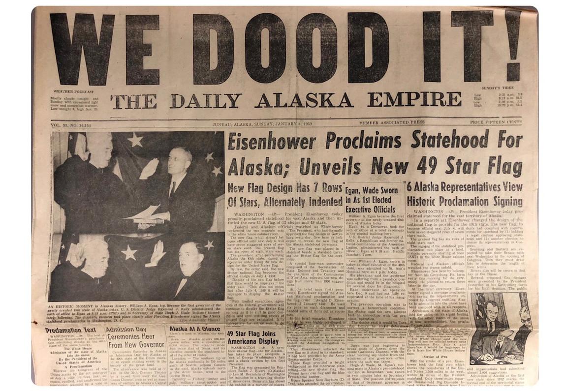
3 January 1959 marks not merely the admission of Alaska as the forty ninth state of the United States, but a historically significant moment representing the transfer of ownership of one of the largest landmasses in modern history.
Prior to attaining statehood, Alaska formed part of the Russian Empire and was known as Russian America. Russian explorers first arrived in the region during the eighteenth century, with their primary interest centred on the lucrative fur trade. Over time, however, this trade declined steadily, reducing the region’s economic value for Russia. Given Alaska’s extreme geographical distance from the Russian mainland, its administration and defence became increasingly costly and impractical. These challenges were compounded by concerns that, in the event of a conflict, Britain, then in control of Canada, could readily seize the territory.
Under these circumstances, Russia concluded that selling the territory to a friendly power would be the most prudent course of action. Consequently, in 1867, Alaska was sold to the United States for a sum of 7.2 million dollars. At the time, the agreement was widely criticised within the United States and derisively labelled Seward’s Folly, after the then Secretary of State, William H. Seward, who negotiated the deal. In later years, however, the discovery of gold, oil and other valuable natural resources transformed this transaction into one of the most advantageous territorial acquisitions in recorded history.
Alaska covers a total area of approximately 375 million acres. With the granting of statehood, the Alaska Statehood Act introduced an unprecedented provision under which the new state was authorised to select and acquire approximately 102 to 103 million acres of federal land. Never before in American history had such an extensive transfer of land been executed under a single legal framework. This decision laid the foundations for structured urban infrastructure, town planning and commercial zoning during Alaska’s formative years as a state.
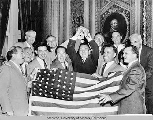
Alaska Territorial Gov. Bob Bartlett in center, with the 49-star flag (Bartlett was one of Alaska’s first U.S. senators).
Before statehood, the value of Alaska’s land was largely associated with gold mining and a limited range of mineral resources. After 1959, however, systematic government surveys, land leasing policies and formal land selection processes brought the region firmly into the focus of investors. Just a few years later, in 1968, the discovery of vast oil reserves in the Prudhoe Bay area fundamentally redefined the economic significance of the land. A barren and frigid region long considered unsuitable for large scale use suddenly emerged as a centre of global energy production. This transformation elevated Alaska’s commercial land to strategic value measured in trillions of dollars.
Following statehood, federal funding accelerated the development of infrastructure, leading to a substantial and decisive rise in land values. Major urban centres such as Anchorage witnessed the establishment of planned housing developments, encouraging organised urban expansion and residential growth. Similarly, the expansion of residential and commercial construction in Fairbanks stimulated economic and social activity in northern regions, improving living standards for local communities and contributing to the state’s overall development.
The construction of roads and transportation networks made previously inaccessible land usable, overcoming geographical barriers that had long restricted development.
Statehood also gave rise to significant disputes over land rights, as the historical claims of Indigenous populations conflicted with federal and state land selection processes. To address these issues, the Alaska Native Claims Settlement Act was enacted in 1971, under which approximately forty four million acres of land were transferred to Native tribal corporations.
▪️Syed Shayan Real Estate Archive
▪ Reference(s):
3 جنوری 1959 کو Alaska کا امریکہ کی انچاسویں ریاست بننا دراصل تاریخ میں ایک بڑے زمینی قطعے کی ملکیت کی منتقلی کا دن ہے۔
امریکی ریاست بننے سے پہلے Alaska دراصل Russia کی سلطنت، یعنی Russian Empire کا حصہ تھا اور اسے Russian America کہا جاتا تھا۔ اٹھارہویں صدی میں روسی مہم جوؤں نے یہاں قدم رکھا، جہاں بنیادی دلچسپی قیمتی فر (fur) کی تجارت تھی، مگر وقت گزرنے کے ساتھ یہ تجارت کمزور ہوتی گئی اور روس کو اس خطے سے معاشی فائدہ تقریباً ختم ہو گیا۔ چونکہ الاسکا جغرافیائی لحاظ سے روس سے انتہائی دور تھا، اس لیے اس کا انتظام اور دفاع روس کے لیے بہت مہنگا اور مشکل بنتا جا رہا تھا، خاص طور پر اس خدشے کے باعث کہ اگر کسی جنگ کی صورت میں برطانیہ، جو اس وقت کینیڈا پر قابض تھا، آسانی سے الاسکا پر قبضہ کر سکتا ہے۔
انہی حالات کے پیشِ نظر روس نے یہ فیصلہ کیا کہ اس خطے کو کسی دوستانہ طاقت کو فروخت کر دینا زیادہ بہتر ہوگا، چنانچہ 1867ء میں الاسکا کو United States کو صرف 7.2 ملین ڈالر میں فروخت کر دیا گیا۔ اس معاہدے کو امریکہ میں ابتدا میں تنقید کا نشانہ بنایا گیا اور اسے “Seward’s Folly” کہا گیا، کیونکہ یہ سودا امریکی وزیرِ خارجہ William H. Seward نے طے کیا تھا، مگر بعد ازاں جب الاسکا میں سونا، تیل اور دیگر قیمتی قدرتی وسائل دریافت ہوئے تو یہی سودا تاریخ کے سب سے کامیاب اور فائدہ مند معاہدوں میں شمار ہونے لگا۔
الاسکا کا مجموعی رقبہ تقریباً تین سو پچہتر ملین ایکڑ پر مشتمل ہے۔ ریاست بننے کے ساتھ ہی Alaska Statehood Act کے تحت امریکی وفاقی حکومت نے ایک غیر معمولی فیصلہ نافذ کیا، جس کے مطابق نئی ریاست کو یہ حق دیا گیا کہ وہ وفاقی اراضی میں سے تقریباً ایک سو دو سے ایک سو تین ملین ایکڑ زمین اپنی ملکیت میں منتخب کر کے منتقل کر لے۔ امریکی تاریخ میں کسی بھی ریاست کو اتنی بڑی زمین ایک ہی قانونی فریم ورک کے تحت منتقل نہیں کی گئی، جس کے نتیجے میں الاسکا کے اوائل دنوں میں باقاعدہ شہری انفراسٹرکچر، ٹاؤن پلاننگ اور کمرشل زوننگ کی بنیاد پڑی۔
ریاستی حیثیت سے قبل الاسکا کی زمین کی قدر زیادہ تر تاریخی طور پر سونے کی کانوں اور محدود معدنی وسائل تک محدود تھی، مگر 1959 کے بعد شروع ہونے والے سرکاری سرویز، لیزنگ پالیسیوں اور زمین کے انتخابی عمل نے اس خطے کو سرمایہ کاروں کے نقشے پر نمایاں کر دیا۔ چند ہی برس بعد، 1968 میں Prudhoe Bay کے علاقے میں تیل کے بڑے ذخائر کی دریافت نے زمین کی معاشی تعریف ہی بدل دی۔ بنجر اور سرد خطہ، جسے طویل عرصہ قابلِ استعمال نہیں سمجھا جاتا تھا، اچانک عالمی توانائی کا مرکز بن گیا۔ اسی تبدیلی نے الاسکا کی کمرشل زمین کو کھربوں ڈالر کی اسٹریٹجک ویلیو تک پہنچایا۔
تصویر میں جو شخصیت درمیان میں نظر آ رہی ہے وہ Bob Bartlett ہیں، جو اس وقت الاسکا کے علاقائی گورنر (Territorial Governor) تھے۔ ان کے اردگرد موجود افراد الاسکا کی سیاسی قیادت اور امریکی وفاقی نمائندے ہیں، اور ان کے ہاتھوں میں 49 ستاروں والا امریکی پرچم موجود ہے جو الاسکا کے امریکہ کی 49ویں ریاست بننے کی علامت تھا۔
ریاست بننے کے بعد وفاقی حکومت کی جانب سے فراہم کیے گئے فنڈز نے انفراسٹرکچر کی ترقی کو نئی رفتار دی، جس کے نتیجے میں زمین کی قیمتوں میں نمایاں اور فیصلہ کن اضافہ ہوا۔ خاص طور پر Anchorage جیسے بڑے شہری مراکز میں باقاعدہ ہاؤسنگ سوسائٹیز قائم ہوئیں، جنہوں نے شہری توسیع اور منظم رہائش کو فروغ دیا۔ اسی طرح Fairbanks میں رہائشی اور تجارتی تعمیرات کے پھیلاؤ نے شمالی علاقوں کو معاشی اور سماجی طور پر متحرک کیا، جس سے نہ صرف مقامی آبادی کو سہولیات میسر آئیں بلکہ خطے کی مجموعی ترقی میں بھی نمایاں بہتری آئی۔
سڑکوں اور ٹرانسپورٹ نیٹ ورک نے ان زمینوں تک رسائی ممکن بنائی جو پہلے جغرافیائی رکاوٹوں کے باعث غیر استعمال شدہ تھیں۔
ریاستی الحاق نے زمین کے حقوق سے متعلق ایک اہم تنازع بھی پیدا کیا، کیونکہ مقامی آبادی کے تاریخی دعوے وفاقی اور ریاستی زمین کے انتخاب سے متصادم ہو رہے تھے۔ اس مسئلے کے حل کے لیے 1971 میں Alaska Native Claims Settlement Act نافذ کیا گیا، جس کے تحت تقریباً چوالیس ملین ایکڑ زمین مقامی قبائلی کارپوریشنز کو منتقل کی گئی۔
▪️ سید شایان ریئل اسٹیٹ آرکائیو

On November 15, 1986 the Gujrat Development Authority launched the Model Town Gujrat Housing Scheme to address rising population pressure and the need for organized residential expansion. During the 1980s Gujrat was transitioning from a semi-rural district center to a rapidly urbanizing city influenced by overseas remittances and growing domestic i...
Read More →
On 10 January 1992, the formal construction of the Lahore Islamabad Motorway M2 was initiated in Pakistan. On this date, the project was officially launched and approved at the government level. This project proved to be the starting point of the modern motorway network concept in Pakistan. The Lahore Islamabad Motorway M2 was the country’s fi...
Read More →
On 11 December 2018, the Supreme Court of Pakistan, under the leadership of then Chief Justice Mian Saqib Nisar, imposed a strict and highly unusual restriction on the transfer, lease, and allotment of land in Sindh. The court directed that until the provincial land revenue record was fully computerised, no allotment, lease, or transfer of governme...
Read More →
On 27 January 1888, the National Geographic Society was established in Washington DC. The purpose of this institution was to advance understanding of the world’s lands, mountains, rivers, cities, regions, and the human and wildlife populations inhabiting them, and to document this knowledge through systematic mapping. Prior to this, land was gen...
Read More →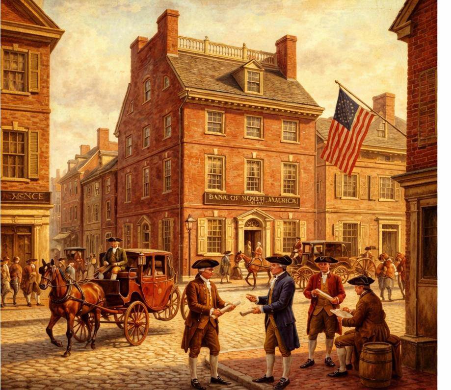
On the 12th of January 1831, a pivotal moment in the annals of global real estate transpired, heralding a transformation in the ownership of land and dwellings from the preserve of the elite to a domain accessible to the broader populace. It was on this date that the inaugural Building and Loan Association, designated as the Oxford Provident, was...
Read More →
The acquisition of land for the Model Town Society was one of the most remarkable and spirited chapters in its early history. Dewan Khem Chand and his...

Between 1921 and 1924, the land for Model Town Lahore was acquired in successive phases. The process began in 1921, shortly after the establishment of...
No comments yet. Be the first to comment!