
Syed Shayan Real Estate Archive
Syed Shayan Real Estate Archive
From Real Estate History
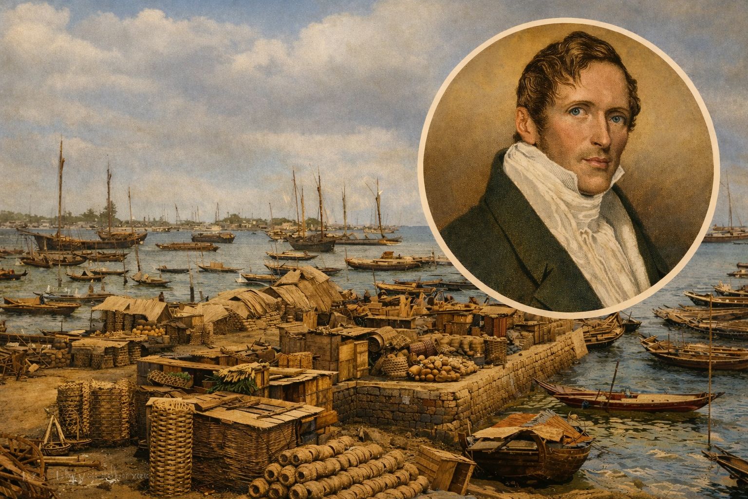
On 29 January 1819, a decision was taken that would quietly but decisively alter the course of maritime trade and urban development in Southeast Asia. On that day, Sir Stamford Raffles, a senior administrator of the British East India Company and then Lieutenant Governor of Bencoolen in Sumatra, arrived at an island that was scarcely more than a scattering of fishing settlements. That island would later become known to the world as Singapore.
Raffles was not engaged in an act of conquest, nor was he founding a city in the conventional sense. His purpose was strategic. Britain sought to secure its commercial interests in the region and to counter the expanding Dutch dominance over regional trade routes. What Raffles undertook at Singapore was, in modern terms, an act of site selection grounded in geography rather than grand design.
At the time of his arrival, Singapore was neither a recognised political entity nor an urban centre. The land fell loosely under the influence of the Sultanate of Johor, and there existed no formal system of land ownership as understood in European legal tradition. Authority over land was exercised through local custom and allegiance rather than written title or registry.
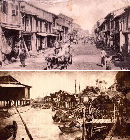
These images document the transitional condition of Singapore in the period following Sir Stamford Raffles’ arrival and his selection of the site in 1819. The coastal scene shown is not simply a depiction of early port activity, but a visual record of the initial economic framework upon which Singapore’s later urban economy was constructed. The wooden vessels, temporary jetties, and shoreline warehouses indicate a space that remained informal in structure, yet was increasingly drawn into regional and international trading networks.The second image, portraying a colonial street lined with shophouses, illustrates the gradual transformation of a port settlement into an ordered urban landscape. When viewed together, these images demonstrate that Singapore’s development was not the result of sudden planning or abrupt intervention, but rather a cumulative process shaped by deliberate land selection, the steady growth of commerce, and the progressive formation of urban infrastructure. It was this measured and sustained evolution that ultimately enabled Singapore to emerge as a major global trading centre and a modern city of lasting historical significance.(Syed Shayan- Archive Head)
The decisive factor in Raffles’ choice lay in Singapore’s geographical position. Situated at the entrance to the Strait of Malacca, the island occupied one of the most critical maritime corridors in the world. For centuries, this narrow passage had carried the flow of trade between China, India, the Arab world, and Europe. To establish a port at this point was, in effect, to place a commercial foothold at the crossroads of global maritime traffic.
Raffles understood that a secure and open port at such a location would draw ships not through coercion, but through convenience. Trade would follow geography, and settlement would follow trade. In this sense, the selection of Singapore was less an act of imperial ambition than a recognition of spatial inevitability.
A formal treaty with the Sultan of Johor and the Temenggong was concluded on 6 February 1819, establishing British administration and granting Singapore the status of a free port. With this, land that had previously existed outside formal legal frameworks entered a new phase of regulated use, construction, and commercial development.
From this single decision emerged a modest port, which gradually evolved into a town, then a city, and eventually a city state. In 1965, Singapore became an independent nation, its foundations still traceable to that initial act of land selection in 1819. Sir Stamford Raffles has since been remembered not merely as an administrator, but as the figure most closely associated with the island’s transformation.
Today, the land once occupied by fishing communities stands among the most valuable and efficiently organised urban and commercial spaces in the world. Singapore ranks among the world’s wealthiest nations by income and economic output. Its port is counted among the busiest globally, commonly ranked second in container traffic, and functions as the world’s largest transshipment hub, a central node in the global shipping network where goods are redistributed across continents.
In the history of urban development and real estate, 29 January 1819 endures as a reminder that the fate of cities is often shaped not by grand proclamations, but by the quiet precision of choosing the right place at the right moment.
▪️Syed Shayan Real Estate Archive
▪ Reference(s):
آج کی تاریخ میں اس دن سر اسٹیمفورڈ ریفلز (Sir Stamford Raffles)، جو برطانوی ایسٹ انڈیا کمپنی کے ایک اعلیٰ منتظم تھے اور اس وقت بینکولن سماٹرا (Bencoolen Sumatra) کے لیفٹیننٹ گورنر کی حیثیت سے تعینات تھے، برطانوی تجارتی مفادات کے تحفظ اور ڈچ تجارتی اجارہ داری (Dutch Monopoly) کا توڑ کرنے کے لیے ایک نئی بندرگاہ کی تلاش میں نکلے اور ایک ایسے جزیرے پر پہنچے جسے آج دنیا سنگاپور کے نام سے جانتی ہے۔ اس وقت سنگاپور کوئی شہر، ریاست یا ملک نہیں تھا بلکہ چند مچھیروں کی بستیاں تھیں، اور یہ علاقہ سلطنتِ جوہر کے زیر اثر سمجھا جاتا تھا۔
ریفلز نے صرف یہ فیصلہ کیا کہ اس جگہ کو ایک بندرگاہی تجارتی اڈے (Trading Post) کے طور پر استعمال کیا جائے گا۔ یہ فیصلہ دراصل زمین کے انتخاب کا ایک غیر معمولی قدم تھا جسے آج کی زبان میں سائٹ سلیکشن کہا جاتا ہے۔ ریفلز نے اس مقام کو اس کے جغرافیائی محلِ وقوع کی بنیاد پر منتخب کیا کیونکہ یہ ایشیا کی سب سے اہم بحری تجارتی گزرگاہ درۂ ملکا (Strait of Malacca) کے دہانے پر واقع تھا۔
درۂ ملکا صدیوں سے چین، ہندوستان، عرب دنیا اور یورپ کے درمیان سمندری تجارت کا مرکزی راستہ رہا ہے۔ اس مقام کا انتخاب ایسا تھا جیسے کوئی شخص دنیا کی سب سے بڑی شاہراہ کے عین چوراہے پر دکان کھول دے۔ جو بھی جہاز مشرق اور مغرب کے درمیان سفر کرتا تھا، اس کے لیے یہاں رکنا فطری امر بن سکتا تھا۔ ریفلز نے سمجھ لیا تھا کہ اگر اس مقام پر ایک محفوظ بندرگاہ قائم کر دی جائے تو تجارت خود بخود یہاں کھنچی چلی آئے گی، اور جہاں تجارت آتی ہے وہاں آبادی، تعمیرات اور شہری ترقی بھی جنم لیتی ہے۔
یہ تصاویر سنگاپور کی اُس عبوری کیفیت کی شہادت ہیں جو 1819 میں سر اسٹیمفورڈ ریفلز کے آمد اور زمین کے انتخاب کے بعد پیدا ہوئی یہاں دکھائی دینے والا ساحلی منظر محض ایک بندرگاہی سرگرمی نہیں بلکہ اُس ابتدائی معاشی ڈھانچے کی جھلک ہے جس پر بعد میں سنگاپور کی شہری معیشت استوار ہوئی لکڑی کی کشتیوں، عارضی گھاٹوں اور ساحل کے ساتھ قائم گوداموں سے ظاہر ہوتا ہے کہ یہ علاقہ اب بھی غیر رسمی مگر بڑھتی ہوئی تجارتی سرگرمیوں کا مرکز تھا دوسری تصویر میں نوآبادیاتی طرز کی گلی اور شاپ ہاؤسز اس تدریجی تبدیلی کی نشاندہی کرتے ہیں جس کے ذریعے بندرگاہی بستی ایک منظم شہری فضا میں تبدیل ہو رہی تھی ان دونوں مناظر کو یکجا دیکھنے سے واضح ہوتا ہے کہ سنگاپور کی ترقی کسی اچانک منصوبے کا نتیجہ نہیں بلکہ زمین کے انتخاب، تجارت کے ارتقا اور شہری انفراسٹرکچر کی بتدریج تشکیل کا حاصل ہے، جس نے بعد ازاں اسے عالمی سطح کا تجارتی مرکز اور عظیم الشان شہر بنایا۔ (سید شایان۔ آرکائیو ہیڈ)
اس وقت سنگاپور میں زمین کی جدید قانونی ملکیت کا کوئی باقاعدہ نظام موجود نہیں تھا۔ زمین نجی جائیداد کے طور پر نہیں بلکہ مقامی حکمرانوں کے اختیار کے تحت سمجھی جاتی تھی۔ چند دن بعد، 6 فروری 1819 کو، سلطانِ جوہر اور مقامی حکمران (Temenggong of Johor) کے ساتھ ایک باقاعدہ معاہدہ طے پایا جس کے نتیجے میں برطانوی انتظام قائم ہوا اور سنگاپور کو فری پورٹ (Free Port) کی حیثیت دی گئی۔
تاریخ ہمیں بتاتی ہے کہ اسٹیمفورڈ ریفلز کے اسی ایک فیصلے کے نتیجے میں جو ایک معمولی بندرگاہ وجود میں آئی، آگے چل کر وہی بندرگاہ شہر بنی، شہر ریاست میں بدلا، اور بالآخر 1965 میں سنگاپور ایک خود مختار ملک (Independent State) بن گیا۔ اور سر اسٹیمفورڈ ریفلز اس سنگا پور کے بانی ٹہرے۔
آج وہی مچھیروں کی ایک بستی جس کا انتخاب 29 جنوری 1819 کو سر اسٹیمفورڈ ریفلز نے ایک بندرگاہ کے طور پر کیا تھا، دنیا کے امیر ترین ممالک میں شامل ہے اور سنگاپور کے نام سے ایک آزاد ملک کے طور پر جانا جاتا ہے۔ سنگاپور کی بندرگاہ کو دنیا کی مصروف ترین بندرگاہوں میں شمار کیا جاتا ہے اور کنٹینر ٹریفک کے لحاظ سے عالمی درجہ بندی میں اسے عموماً دوسرے نمبر پر رکھا جاتا ہے۔ یہ بندرگاہ دنیا کا سب سے بڑا transshipment hub بھی ہے، یعنی عالمی شپنگ نیٹ ورک میں سب سے زیادہ مربوط اور فعال مرکز، جہاں کنٹینرز ایک بندرگاہ سے دوسری بندرگاہ منتقل کیے جاتے ہیں۔
▪️ سید شایان ریئل اسٹیٹ آرکائیو
20 نومبر 1984 کو شینزن میونسپل حکومت نے باؤآن کوسٹل اربن گرین لائن آرڈیننس نافذ کیا، جو صنعتی ترقی کے دوران ماحولیاتی تحفظ اور شہری منصوبہ بندی کا ایک اہم سنگ میل تھا۔ 1980 کی دہائی میں شینزن تیزی سے ...
مزید پڑھیں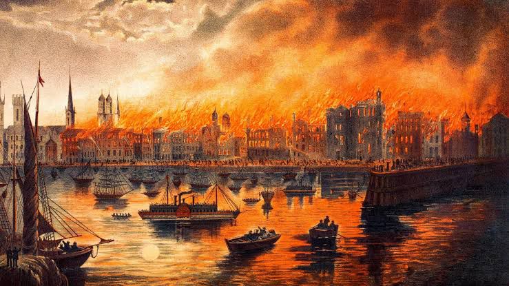
8 اکتوبر 1871 کو ریاستِ الینوئے کے شہر شکاگو میں ایک تباہ کن آگ بھڑک اٹھی جس نے 17 ہزار سے زائد عمارتیں جلا دیں، 3.3 مربع میل رقبے کو راکھ میں بدل دیا اور ایک لاکھ سے زیادہ افراد کو بے گھر کر دیا۔ لکڑی �...
مزید پڑھیں
29 دسمبر 1845 کو ٹیکساس باضابطہ طور پر امریکہ کی اٹھائیسویں ریاست بنا۔ یہ واقعہ محض ایک سیاسی فیصلہ نہیں تھا بلکہ زمینی ملکیت اور رئیل اسٹیٹ کی عالمی تاریخ کا ایک غیر معمولی موڑ ثابت ہوا۔ اس ایک دن ...
مزید پڑھیں
12 نومبر 1885 کو پیرس میں ہاسمن کی شہری اصلاحات سے متاثر ہو کر ایک بڑے پیمانے پر مضافاتی توسیعی منصوبے کا آغاز کیا گیا۔ فرانسیسی حکومت نے صنعتی ترقی اور بڑھتی ہوئی آبادی کو منظم کرنے کے لیے شہر کی د�...
مزید پڑھیں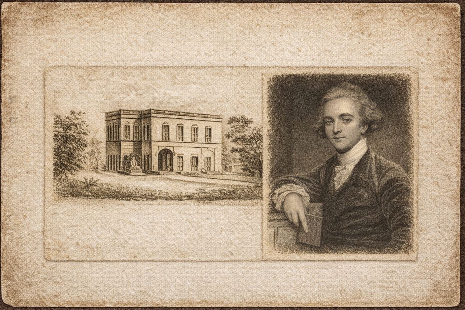
آج سے ٹھیک 242 سال پہلے، 15 جنوری 1784 کو کلکتہ میں ایشیاٹک سوسائٹی آف بنگال (Asiatic Society of Bengal) کی بنیاد سر ولیم جونز (Sir William Jones) نے رکھی۔ اسی روز سوسائٹی کا پہلا باضابطہ اجلاس منعقد ہوا۔ یہ ادارہ برصغیر...
مزید پڑھیں
ماڈل ٹاؤن لاہور ایک جدید رہائشی سوسائٹی جو لاہور کے قدیمی جنگل میں بسائی گئی ماڈل ٹاؤن سوسائٹی کے لیے زمین کی خریداری اور حصول بھی ایک نہایت ...

ماڈل ٹاؤن سوسائٹی کی 500 ایکڑ زمین کہاں گئی؟ ماڈل ٹاؤن لاہور کی زمین 1921 سے 1924 کے درمیان مختلف مرحلوں میں خریدی گئی۔ ابتدا 1921 میں ہوئی جب...
No comments yet. Be the first to comment!