
Syed Shayan Real Estate Archive
Syed Shayan Real Estate Archive
From Real Estate History
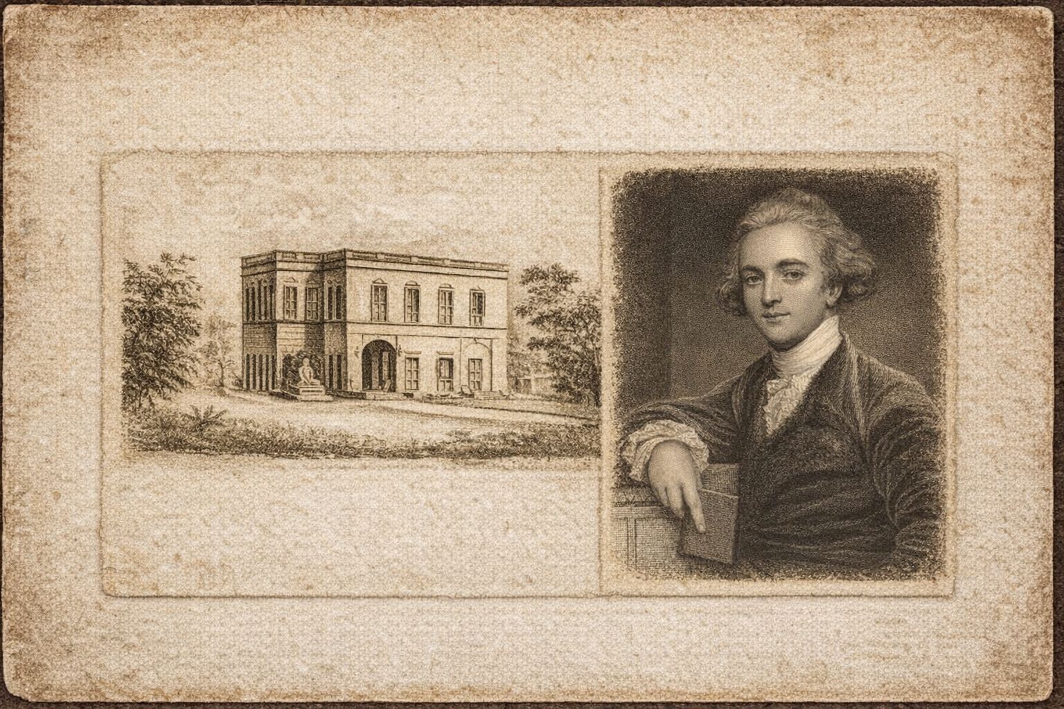
Exactly 242 years ago, on 15 January 1784, the Asiatic Society of Bengal was founded in Calcutta by Sir William Jones. On the same day, the Society convened its first formal meeting. The institution emerged as the earliest organised centre in the subcontinent dedicated to the systematic study of ancient manuscripts, archaeology, and geographical knowledge relating to land ownership and territorial organisation.
In the subcontinent, the concept of land ownership was never confined solely to oral tradition. From ancient and medieval periods onward, land related information was preserved through a variety of written and material sources.
During the eras of Mohenjo-daro, Harappa, and early Taxila, land ownership and registration did not exist in the modern sense of individual title or legal transfer. Nevertheless, land was not without structure or regulation. In the urban centres of Mohenjo-daro and Harappa, land administration functioned under state control. Entire cities were organised through deliberate planning, grid based layouts, standardised measurements, and clearly defined boundaries. Houses, streets, and urban blocks were constructed according to predetermined plans, demonstrating that land distribution and use were governed by administrative systems rather than customary practice. In this period, land was regarded as the property of the state or city, while individuals held rights of use rather than absolute ownership.
In later periods, particularly during the era of Taxila, the state began granting land to religious and educational institutions. These grants were formally recorded on stone inscriptions or copper plates. Such written records of land grants and boundary demarcation formed the earliest foundations of structured land registration, ownership documentation, and systems of transfer in subsequent eras.
In ancient South Asia, whenever a ruler or state authority granted land to an individual, family, religious institution, or administrative body, the decision was accorded legal authority by engraving it on copper plates or stone inscriptions. These records functioned as the equivalent of land registers or title documents of their time, detailing boundaries, ownership rights, and royal seals.
Established on 15 January 1784, the Asiatic Society of Bengal collected these ancient documents, land grants, boundary inscriptions, and local maps and organised them on a scientific basis. Scholars associated with the Society studied, decoded, and compiled land grants recorded on copper plates and stone inscriptions, demonstrating that principles of land ownership, boundary definition, and transfer had existed in written form across the subcontinent for centuries.
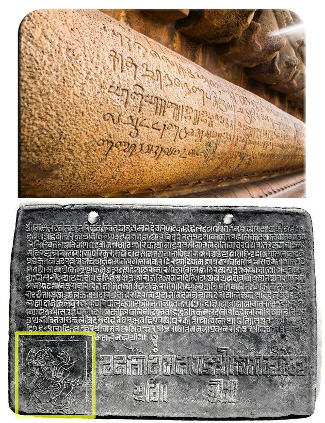
These copper plates and stone inscriptions functioned as the official legal records of ancient societies.They documented land ownership, royal decrees, grants, and judicial decisions, as paper either did not yet exist or was not regarded as durable or reliable.Simply put:They were the registries, land records, and formal government documents of their time.
This structured body of geographical and historical knowledge subsequently provided the intellectual foundation for scientific survey initiatives, most notably the Great Trigonometrical Survey. Through this process, accurate land measurement and systematic mapping became possible, laying the groundwork for modern land record systems.
The extensive scholarly material assembled by the Asiatic Society provided the British administration with the basis upon which official institutions for scientific land measurement, boundary demarcation, and systematic cartography were established throughout the subcontinent.
These historical records and geographical terminologies later informed major projects such as the Survey of India and the Great Trigonometrical Survey. The modern systems of land registration, land settlement, revenue mapping, and digital land records in use today would not have been possible without these ancient material sources and the scholarly work undertaken by the Asiatic Society.
According to historians of land and geography, 15 January 1784 marks the beginning of a systematic process through which the territory of the subcontinent began to be formally documented, a development that may be regarded as the earliest precursor to contemporary digital land record systems.
▪️Syed Shayan Real Estate Archive
▪ Reference(s):
آج سے ٹھیک 242 سال پہلے، 15 جنوری 1784 کو کلکتہ میں ایشیاٹک سوسائٹی آف بنگال (Asiatic Society of Bengal) کی بنیاد سر ولیم جونز (Sir William Jones) نے رکھی۔ اسی روز سوسائٹی کا پہلا باضابطہ اجلاس منعقد ہوا۔ یہ ادارہ برصغیر میں زمین کی ملکیت سے متعلق قدیم مخطوطات، آثارِ قدیمہ اور جغرافیائی معلومات کے منظم مطالعے کا پہلا بڑا مرکز بنا۔
برصغیر میں زمین کی ملکیت کا تصور محض زبانی روایات تک محدود نہیں تھا بلکہ اسے قدیم اور قرونِ وسطیٰ کے ادوار سے ہی مختلف تحریری اور مادی ذرائع میں محفوظ کیا جاتا رہا ہے۔
موہنجوداڑو، ہڑپہ اور ابتدائی ٹیکسلا کے ادوار میں زمین کی ملکیت اور رجسٹری آج کے معنوں میں فرد یا انتقال کی صورت میں موجود نہیں تھی، لیکن زمین بغیر کسی نظام کے بھی نہیں تھی۔ موہنجوداڑو اور ہڑپہ کے شہری مراکز میں زمین کا انتظام ریاستی کنٹرول کے تحت تھا، جہاں پورے شہر کو باقاعدہ منصوبہ بندی، گرڈ سسٹم، معیاری پیمائش اور واضح حد بندی کے ذریعے منظم کیا گیا۔ مکانات، گلیاں اور بلاکس ایک طے شدہ نقشے کے مطابق تعمیر ہوتے تھے، جو اس بات کا ثبوت ہے کہ زمین کی تقسیم اور استعمال زبانی نہیں بلکہ انتظامی منصوبہ بندی کے تحت تھا۔ اس دور میں زمین شخصی ملکیت کے بجائے ریاست یا شہر کی ملکیت سمجھی جاتی تھی اور افراد کو صرف استعمال کا حق حاصل ہوتا تھا۔
بعد ازاں ٹیکسلا کے دور میں پہلی مرتبہ ریاست کی طرف سے مذہبی یا تعلیمی اداروں کو زمین بطور عطیہ کرنے کی مثالیں سامنے آئیں، جنہیں پتھری کتبوں یا تانبے کی پلیٹوں پر درج کیا جاتا تھا۔ یہی تحریری عطیات اور حد بندی کے ریکارڈ بعد کے ادوار میں باقاعدہ رجسٹری، فرد اور انتقالِ اراضی کے نظام کی ابتدائی بنیاد بنے۔
قدیم برصغیر میں جب بھی کوئی ریاست یا حکمران کسی فرد، خاندان، مذہبی ادارے یا انتظامی اکائی کو زمین عطا کرتا تو اس فیصلے کو قانونی تحفظ دینے کے لیے تانبے کی پلیٹوں (Copper Plates) یا پتھری کتبوں پر کندہ کر دیا جاتا تھا۔ یہ قدیم کتبے اور پلیٹیں اس دور کی “رجسٹری” یا “فرد” کا درجہ رکھتی تھیں، جن پر زمین کی حدود، ملکیت کے حقوق اور شاہی مہریں درج ہوتی تھیں۔
یہ تانبے کی تختیاں اور پتھری کتبے قدیم زمانے کی سرکاری اور قانونی دستاویزات تھے، ان پر زمین کی ملکیت، حکمرانوں کے احکامات، عطیات اور فیصلے کندہ کیے جاتے تھے، کیونکہ اُس دور میں کاغذ موجود نہیں تھا یا قابلِ اعتماد نہیں سمجھا جاتا تھا، سادہ لفظوں میں یہ اُس زمانے کی زمین کی رجسٹری، فرد اور سرکاری ریکارڈ تھے۔
15 جنوری 1784 کو قائم ہونے والی ایشیاٹک سوسائٹی نے ان ہی قدیم دستاویزات، زمین کے عطیات، سرحدی تحریروں اور مقامی نقشوں کو اکٹھا کر کے انہیں سائنسی بنیادوں پر مرتب کیا۔
سوسائٹی کے ماہرین نے قدیم کتبوں اور تانبے کی پلیٹوں پر درج زمین کے عطیات (Land Grants) کو پڑھا، ڈی کوڈ کیا اور مرتب کیا، جس سے یہ واضح ہوا کہ برصغیر میں زمین کی ملکیت، حد بندی اور انتقال کے اصول صدیوں پہلے تحریری شکل میں موجود تھے۔ اسی منظم جغرافیائی علم نے بعد ازاں گریٹ ٹرگنومیٹریکل سروے (Great Trigonometrical Survey) جیسے سائنسی سروے (Survey) منصوبوں کی فکری بنیاد رکھی، جس کے نتیجے میں زمین کی درست پیمائش اور نقشہ سازی (Mapping) ممکن ہوئی اور جدید لینڈ ریکارڈ نظام کی تشکیل کا راستہ ہموار ہوا۔
اسی ادارے کے تیار کردہ اس عظیم علمی مواد نے برطانوی حکومت کو وہ بنیاد فراہم کی جس پر برصغیر میں زمین کی سائنسی پیمائش، حد بندی اور باقاعدہ نقشہ سازی کے سرکاری ادارے قائم کیے گئے۔
یہی تاریخی ریکارڈ اور جغرافیائی اصطلاحات بعد میں “سروے آف انڈیا” اور “عظیم جغرافیائی سروے” (GTS) جیسے بڑے منصوبوں کے لیے فکری معاون ثابت ہوئیں۔ آج ہم زمین کی رجسٹری، بندوبستِ اراضی، ریونیو نقشوں اور جدید ڈیجیٹل لینڈ ریکارڈ سسٹم کی جو شکل دیکھتے ہیں، وہ ان ہی قدیم مادی ذرائع اور ایشیاٹک سوسائٹی کی علمی کاوشوں کے بغیر ممکن نہ تھی۔
زمینی تاریخ کے ماہرین کے مطابق 15 جنوری 1784 ہی وہ دن ہے جب برصغیر کے طول و عرض کو دستاویزی شکل دینے کا باقاعدہ عمل شروع ہوا، جسے آج کے “ڈیجیٹل لینڈ ریکارڈ” کی ابتدائی کڑی قرار دیا جا سکتا ہے۔
▪️ سید شایان ریئل اسٹیٹ آرکائیو
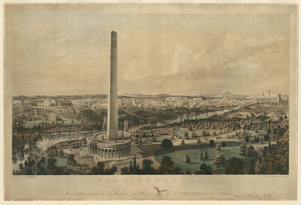
On October 9, 1888, the Washington Monument in Washington D.C. was officially opened to the public. Standing 555 feet tall, it was the tallest man-made structure in the world until the completion of the Eiffel Tower in 1889. Its construction, delayed for decades due to funding issues and the American Civil War, became a lasting symbol of civic visi...
Read More →
In 2021, the Federal Reserve introduced a series of strategic interventions aimed at stabilizing the U.S. real estate market amid growing concerns over housing affordability and financial volatility following the pandemic. Through a combination of monetary policy adjustments, including low interest rates, large-scale asset purchases, and liquidity ...
Read More →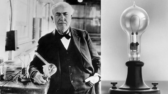
Although Thomas Edison had already developed the electric light bulb in 1879 and had illuminated public spaces on a commercial scale in New York through the Pearl Street Power Station in 1882, the use of electricity at that stage remained limited to a small number of buildings and confined areas. On 19 January 1883, in the town of Roselle, New Jer...
Read More →On November 24, 1990, the Government of Pakistan launched a nationwide overhaul of the aging railway system to address decades of underinvestment, slow transport speeds, and rising maintenance failures. The Ministry of Railways introduced new repair programs, upgraded signaling technology, and initiated phased restoration of passenger and freight r...
Read More →
On November 3, 1993, the implementation of the Maastricht Treaty revolutionized European real estate markets by establishing the framework for a unified property investment zone. The treaty's provisions for free movement of capital and persons enabled cross-border property ownership and investment across EU member states. This led to the emergence ...
Read More →
The acquisition of land for the Model Town Society was one of the most remarkable and spirited chapters in its early history. Dewan Khem Chand and his...

Between 1921 and 1924, the land for Model Town Lahore was acquired in successive phases. The process began in 1921, shortly after the establishment of...
No comments yet. Be the first to comment!