
Syed Shayan Real Estate Archive
Syed Shayan Real Estate Archive
From Real Estate History
On This Date
The first permanent bridge between Buda and Pest established a dependable Danube crossing, connecting the urban centres that later became part of Hungary’s unified capital.
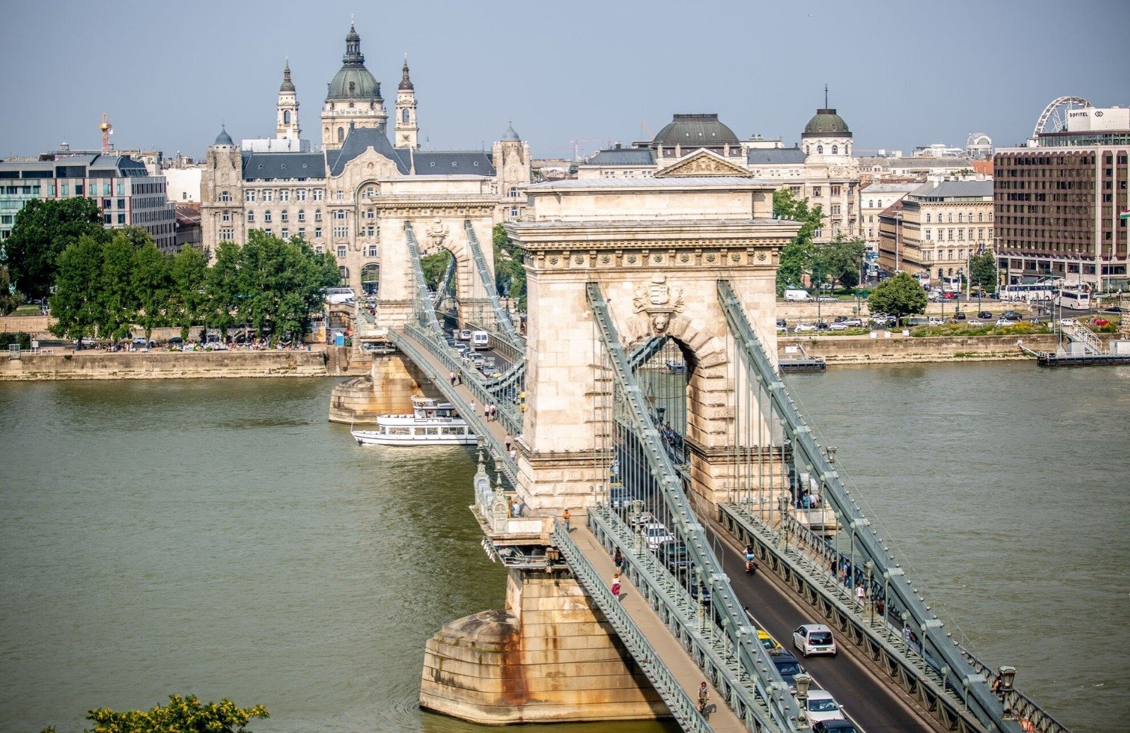
The first permanent bridge between Buda and Pest established a dependable Danube crossing, connecting the urban centres that later became part of Hungary’s unified capital.
Private investment financed the suspension bridge, while its construction, subsequent public ownership and rebuilding illustrate the relationship between infrastructure and urban development. On 20 November 1849, the Chain Bridge opened to the public across the Danube, establishing the first permanent bridge connection between Buda and Pest. The opening brought a decade-long construction project into use and addressed a practical obstacle facing the growing settlements. Before its construction, a floating boat bridge provided a crossing that had to be dismantled during winter. The new structure offered a lasting physical connection between the riverbanks. Count István Szechenyi promoted the project, helping secure its legal framework, financing, and engineering expertise. Construction began in 1839, and the ceremonial foundation stone was laid on 24 August 1842. English engineer William Tierney Clark designed the suspension bridge, while Scottish engineer Adam Clark supervised the work. At approximately 380 metres long, it became a major engineering achievement and an enduring feature of the riverfront. Széchenyi István Levelezesei
The undertaking required an international supply network alongside local production. Granite for the piers came from Mauthausen in Austria, while much of the ironwork was manufactured in England. Brickworks in Pest and Obuda supplied materials, and a local plant produced cement. Its suspension design limited the number of supports in the river, reducing obstructions to winter ice flows. The construction therefore combined decisions about materials, logistics and the physical conditions of the Danube.
Private capital financed the bridge through a joint-stock company organised by Viennese banker Baron Georg Sina. Investors included banking interests, Hungarian merchants and landowners, while Szechenyi purchased a substantial shareholding. Tolls supported the investment, and the legal arrangements required nobles to pay for crossing alongside other users. In 1870, the government purchased the bridge from the company, bringing the crossing into public ownership. Szechenyi István Levelezesei
For real estate and urban planning, the bridge’s importance lies in the access it created between two established urban centres. A permanent crossing made their connection less dependent on seasonal arrangements. It also preceded the administrative unification of Buda, Pest and Óbuda in 1873. UNESCO describes the bridge as a symbol of that eventual union and places it within Budapest’s wider development into a modern metropolis. The connection between transport infrastructure and the organisation of the city gives the anniversary its relevance to property and development history. Szechenyi István Levelezesei
The bridge visible today also reflects later reconstruction. Retreating German troops destroyed it in January 1945, and it reopened on 20 November 1949, exactly a century after its original opening. Reconstruction retained its historic appearance while widening the roadway. Within Budapest’s UNESCO-listed Danube landscape, the crossing remains both functioning infrastructure and a protected element of the city’s built heritage. Its history records how investment created a new connection, public ownership followed, and reconstruction preserved the landmark’s place in the city.
▪️Syed Shayan Real Estate Archive
▪ Reference(s):
On This Date
بُدا اور پَیست کے درمیان پہلے مستقل پل نے دریائے ڈینیوب پر قابلِ اعتماد گزرگاہ فراہم کی اور ان شہری مراکز کو آپس میں جوڑ دیا، جو بعد میں ہنگری کے متحدہ دارالحکومت بُڈاپَیست کا حصہ بنے۔
بودا اور پیسٹ کے درمیان پہلے مستقل پل نے دریائے ڈینیوب عبور کرنے کا قابلِ اعتماد راستہ فراہم کیا اور ان شہری مراکز کو جوڑا جو بعد میں ہنگری کے متحدہ دارالحکومت کا حصہ بنے۔ نجی سرمایہ کاری سے تعمیر ہونے والے اس معلق پل کی تعمیر، بعد میں سرکاری ملکیت میں منتقلی اور تعمیرِ نو، بنیادی ڈھانچے اور شہری ترقی کے باہمی تعلق کو واضح کرتی ہے۔
20 نومبر 1849 کو دریائے ڈینیوب پر چین برج عوام کے لیے کھول دیا گیا، جس سے بودا اور پیسٹ کے درمیان پہلا مستقل پل قائم ہوا۔ اس افتتاح کے ساتھ دس سالہ تعمیراتی منصوبہ مکمل ہوا اور بڑھتے ہوئے شہری مراکز کو درپیش آمدورفت کی ایک بڑی رکاوٹ دور ہوگئی۔ اس سے پہلے دریا عبور کرنے کے لیے کشتیوں پر قائم تیرتا ہوا پل استعمال کیا جاتا تھا، جسے سردیوں میں ہٹانا پڑتا تھا۔ نئے پل نے دریا کے دونوں کناروں کے درمیان مستقل زمینی رابطہ فراہم کیا۔
کاؤنٹ اِشتوان سیچینی نے منصوبے کو آگے بڑھانے میں اہم کردار ادا کیا اور اس کے قانونی تقاضوں، مالی وسائل اور انجینئرنگ مہارت کی فراہمی میں معاونت کی۔ تعمیر 1839 میں شروع ہوئی، جبکہ 24 اگست 1842 کو باضابطہ طور پر سنگِ بنیاد رکھا گیا۔ انگریز انجینئر ولیم ٹیرنی کلارک نے معلق پل کا ڈیزائن تیار کیا اور اسکاٹش انجینئر ایڈم کلارک نے تعمیراتی کام کی نگرانی کی۔ تقریباً 380 میٹر طویل یہ پل انجینئرنگ کا نمایاں کارنامہ اور دریائی منظرنامے کی مستقل پہچان بن گیا۔
منصوبے کے لیے مقامی پیداوار کے ساتھ بین الاقوامی سطح پر تعمیراتی سامان کی فراہمی بھی ضروری تھی۔ پل کے پایوں کے لیے گرینائٹ آسٹریا کے ماؤتھاؤزن سے لایا گیا، جبکہ لوہے کا بیشتر کام انگلینڈ میں تیار ہوا۔ پیسٹ اور اوبودا کے بھٹوں نے اینٹیں فراہم کیں اور ایک مقامی کارخانے میں سیمنٹ تیار کیا گیا۔ معلق ڈیزائن کی بدولت دریا کے اندر کم ستونوں کی ضرورت پڑی، جس سے سردیوں میں بہنے والی برف کے راستے میں رکاوٹیں کم ہوئیں۔ یوں تعمیراتی منصوبہ بندی میں سامان، نقل و حمل اور دریا کے قدرتی حالات کو یکجا رکھا گیا۔
پل کی تعمیر کے لیے ویانا کے بینکار بیرن گیورگ سینا کی قائم کردہ مشترکہ حصص والی کمپنی کے ذریعے نجی سرمایہ جمع کیا گیا۔ سرمایہ کاروں میں بینکاری ادارے، ہنگری کے تاجر اور زمینوں کے مالکان شامل تھے، جبکہ سیچینی نے بھی بڑی تعداد میں حصص خریدے۔ سرمایہ کاری کی واپسی کے لیے ٹول وصول کیا جاتا تھا اور قانونی انتظامات کے تحت اشرافیہ کو بھی دیگر صارفین کی طرح پل عبور کرنے کی فیس ادا کرنا پڑتی تھی۔ 1870 میں حکومت نے کمپنی سے پل خرید لیا، جس کے بعد یہ سرکاری ملکیت میں آگیا۔
رئیل اسٹیٹ اور شہری منصوبہ بندی کے لحاظ سے پل کی اہمیت دو آباد شہری مراکز کے درمیان رسائی بہتر بنانے میں ہے۔ مستقل راستے کی فراہمی سے ان کا باہمی رابطہ موسمی انتظامات پر کم انحصار کرنے لگا۔ یہ پل بودا، پیسٹ اور اوبودا کے 1873 میں انتظامی انضمام سے پہلے تعمیر ہوا تھا۔ یونیسکو اسے اس بعد کے اتحاد کی علامت قرار دیتا ہے اور بوداپست کے جدید شہر بننے کے عمل کا حصہ تسلیم کرتا ہے۔ آمدورفت کے بنیادی ڈھانچے اور شہر کی تشکیل کے درمیان یہی تعلق اس تاریخی واقعے کو پراپرٹی اور شہری ترقی کے موضوعات سے جوڑتا ہے۔
آج نظر آنے والا پل بعد کی تعمیرِ نو کی عکاسی بھی کرتا ہے۔ پسپا ہوتی جرمن فوج نے جنوری 1945 میں اسے تباہ کردیا تھا۔ اسے 20 نومبر 1949 کو، اصل افتتاح کے ٹھیک ایک سو سال بعد، دوبارہ کھولا گیا۔ تعمیرِ نو کے دوران تاریخی ظاہری شکل برقرار رکھتے ہوئے سڑک کو چوڑا کیا گیا۔ بوداپست کے یونیسکو کے عالمی ورثے میں شامل دریائی منظرنامے میں یہ پل آج بھی آمدورفت کی فعال سہولت اور شہر کے محفوظ تعمیراتی ورثے کا حصہ ہے۔ اس کی تاریخ بتاتی ہے کہ کس طرح سرمایہ کاری سے مستقل رابطہ قائم ہوا، پھر سرکاری ملکیت میں منتقلی اور تعمیرِ نو کے ذریعے شہر میں اس تاریخی مقام کی حیثیت برقرار رکھی گئی۔
▪️ سید شایان ریئل اسٹیٹ آرکائیو
▪ حوالہ جات:
On This Date
On 20 November 1850 Wisconsin’s first railway journey helped pave the way for better trade, settlement and land development.
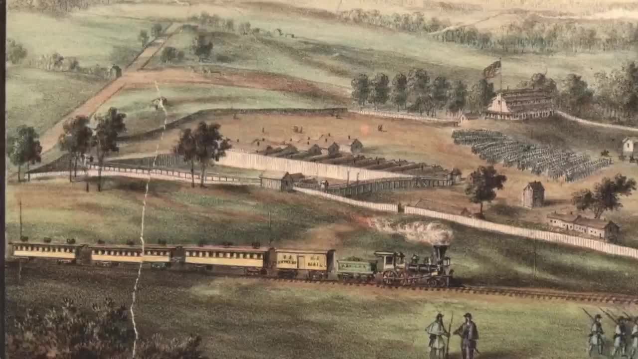
The developing rail network improved access to agricultural land, connected producers with markets and helped shape investment in farms, settlements, and urban infrastructure. On 20 November 1850, an inaugural train carrying company directors and invited dignitaries travelled over five miles of newly laid track between Milwaukee and Wauwatosa in Wisconsin, United States. Operated by the Milwaukee and Mississippi Railroad, the journey demonstrated the first completed section of a project intended to connect Milwaukee with communities farther west. The directors’ excursion preceded the formal opening of regular service to Waukesha on 25 February 1851. Wisconsin Association of Railroad Passengers
The project began with a charter obtained in 1847 for the Milwaukee and Waukesha Railroad. Milwaukee businessman and civic leader Byron Kilbourn promoted the undertaking, which subsequently became the Milwaukee and Mississippi Railroad. Contractors started grading the route in late 1849, preparing the ground for tracks that would extend inland from Milwaukee. The railway’s ambitions eventually reached beyond Waukesha towards Madison and the Mississippi River, establishing the beginnings of a regional transport corridor. Milwaukee Road
Construction required coordination between land surveying, earthworks and material deliveries. Iron rails and rolling stock arrived by water from the eastern United States before track laying began in late summer 1850. The initial depot stood on Second Street in Milwaukee, and the route followed the Menomonee River towards Wauwatosa. These decisions established where passengers and freight would enter the railway and how the developing line would connect with the city’s existing streets and waterfront transport facilities. Wisconsin Association of Railroad Passengers
The wider economic case for rail construction rested heavily on agriculture. Wheat production was expanding, and farmers needed dependable transport to reach eastern markets. The Wisconsin Historical Society records that railway supporters also expected improved connections to encourage settlement. Communities competed to become railway terminals because access to transport could strengthen their position in regional trade. For land development, the railway created a practical link between productive farmland, growing settlements and the shipping facilities of Lake Michigan. Wisconsin Historical Society
As services developed, the railway influenced infrastructure and businesses around its stations. Milwaukee residents sought better sidewalks leading to the depot, while a hotel advertised transport for arriving passengers. Freight costs also fell. An account published by the Wisconsin Association of Railroad Passengers records that moving a barrel of flour from Waukesha to Milwaukee cost 10 cents by rail, compared with 25 cents by horse team. Those changes illustrate how a railway could affect both commercial activity and the facilities needed around a transport hub. Wisconsin Association of Railroad Passengers
The line reached Madison in 1854 and Prairie du Chien on the Mississippi in 1857. Its expansion formed part of a broader transformation in which Wisconsin’s wealth flowed into construction, land investment and development projects. Railways helped farmers reach buyers and enabled newcomers to establish farms and villages. The five-mile inaugural journey of November 1850 therefore belongs to real estate history through the physical corridor it established and the wider pattern of development that railway access supported.
▪️Syed Shayan Real Estate Archive
▪ Reference(s):
On This Date
20 نومبر 1850 کو امریکی ریاست وسکونسن میں پہلی ریل گاڑی کے سفر نے تجارت، آبادکاری اور اراضی کی ترقی کی نئی راہیں ہموار کیں۔
ریلوے نیٹ ورک کی توسیع سے زرعی زمینوں تک رسائی بہتر ہوئی، کاشتکاروں کا منڈیوں سے رابطہ قائم ہوا اور کھیتوں، نئی آبادیوں اور شہری بنیادی ڈھانچے میں سرمایہ کاری کو فروغ ملا۔
20 نومبر 1850 کو کمپنی کے ڈائریکٹرز اور مدعو معززین کو لے جانے والی افتتاحی ٹرین نے امریکی ریاست وسکونسن کے شہر ملواکی اور واواٹوسا کے درمیان نئی بچھائی گئی پٹری پر پانچ میل کا سفر طے کیا۔ ملواکی اینڈ مسیسیپی ریل روڈ کے تحت چلنے والی اس ٹرین نے اس منصوبے کے پہلے مکمل شدہ حصے کو عملی طور پر استعمال میں لانے کا مظاہرہ کیا، جس کا مقصد ملواکی کو مغرب میں واقع آبادیوں سے جوڑنا تھا۔ ڈائریکٹرز کے اس افتتاحی سفر کے بعد واکیشا تک باقاعدہ سروس کا باضابطہ آغاز 25 فروری 1851 کو ہوا۔
منصوبے کی بنیاد 1847 میں ملواکی اینڈ واکیشا ریل روڈ کے لیے حاصل کیے گئے قانونی اجازت نامے سے پڑی۔ ملواکی کے کاروباری اور شہری رہنما بائرن کِل بورن نے اس منصوبے کو آگے بڑھایا، جو بعد میں ملواکی اینڈ مسیسیپی ریل روڈ بن گیا۔ ٹھیکیداروں نے 1849 کے اواخر میں راستے کی زمین ہموار کرنے کا کام شروع کیا تاکہ ملواکی سے اندرونِ ریاست جانے والی پٹری بچھائی جاسکے۔ منصوبے کو بعد میں واکیشا سے آگے میڈیسن اور دریائے مسیسیپی تک لے جانے کا ہدف مقرر کیا گیا، جس سے ایک علاقائی نقل و حمل کی راہداری کی بنیاد پڑی۔
تعمیر کے لیے زمین کے سروے، کھدائی، بھرائی اور سامان کی فراہمی میں مربوط انتظام ضروری تھا۔ 1850 کے موسمِ گرما کے اواخر میں پٹری بچھانے سے پہلے لوہے کی ریلیں، انجن اور بوگیاں مشرقی امریکا سے آبی راستے کے ذریعے لائے گئے۔ ابتدائی ریلوے اسٹیشن ملواکی کی سیکنڈ اسٹریٹ پر قائم تھا، جبکہ راستہ دریائے مینومنی کے ساتھ واواٹوسا کی جانب جاتا تھا۔ ان فیصلوں سے مسافروں اور مال برداری کے لیے ریلوے تک رسائی کے مقامات متعین ہوئے اور نئی لائن کو شہر کی موجودہ سڑکوں اور آبی نقل و حمل کی سہولیات سے جوڑا گیا۔
ریلوے کی تعمیر کا وسیع معاشی جواز بڑی حد تک زراعت سے وابستہ تھا۔ گندم کی پیداوار بڑھ رہی تھی اور کاشتکاروں کو مشرقی منڈیوں تک پہنچنے کے لیے قابلِ اعتماد نقل و حمل درکار تھی۔ وسکونسن ہسٹاریکل سوسائٹی کے مطابق ریلوے کے حامیوں کو توقع تھی کہ بہتر رابطوں سے نئی آبادکاری کو بھی فروغ ملے گا۔ مختلف آبادیاں ریلوے کے آخری اسٹیشن کا مقام بننے کے لیے مقابلہ کررہی تھیں، کیونکہ نقل و حمل تک رسائی علاقائی تجارت میں ان کی حیثیت مضبوط کرسکتی تھی۔ زمین کی ترقی کے لحاظ سے ریلوے نے زرعی اراضی، بڑھتی ہوئی آبادیوں اور جھیل مشی گن کی بحری ترسیلی سہولیات کے درمیان عملی رابطہ قائم کیا۔
سروس میں اضافے کے ساتھ ریلوے نے اسٹیشنوں کے اطراف بنیادی ڈھانچے اور کاروباری سرگرمیوں کو بھی متاثر کیا۔ ملواکی کے رہائشیوں نے اسٹیشن تک جانے والے فٹ پاتھ بہتر بنانے کا مطالبہ کیا، جبکہ ایک ہوٹل نے آنے والے مسافروں کے لیے سواری کی سہولت کا اشتہار دیا۔ مال برداری کے اخراجات بھی کم ہوئے۔ وسکونسن ایسوسی ایشن آف ریل روڈ پیسنجرز کے شائع کردہ بیان کے مطابق واکیشا سے ملواکی تک آٹے کا ایک بیرل پہنچانے کا خرچ ریلوے کے ذریعے 10 سینٹ تھا، جبکہ گھوڑا گاڑی سے یہی کام 25 سینٹ میں ہوتا تھا۔ ان تبدیلیوں سے واضح ہوتا ہے کہ ریلوے کس طرح تجارتی سرگرمیوں اور نقل و حمل کے مرکز کے گرد ضروری سہولیات پر اثرانداز ہوئی۔
ریلوے لائن 1854 میں میڈیسن اور 1857 میں دریائے مسیسیپی پر واقع پریری ڈو شین تک پہنچ گئی۔ اس کی توسیع ایک وسیع تبدیلی کا حصہ تھی، جس کے دوران وسکونسن کا سرمایہ تعمیرات، زمین کی خریداری اور ترقیاتی منصوبوں میں لگایا گیا۔ ریلوے نے کاشتکاروں کو خریداروں تک پہنچنے میں مدد دی اور نئے آنے والوں کے لیے کھیت اور بستیاں آباد کرنا آسان بنایا۔ یوں نومبر 1850 کا پانچ میل طویل افتتاحی سفر رئیل اسٹیٹ کی تاریخ سے اس راہداری اور اس کے نتیجے میں فروغ پانے والی زمینی و شہری ترقی کے ذریعے جڑتا ہے۔
▪️ سید شایان ریئل اسٹیٹ آرکائیو
▪ حوالہ جات:
On October 21, 1959, Pakistan launched its first House Building Finance Scheme through the House Building Finance Corporation (HBFC). This initiative aimed to p...
Read More →
On 21 November 1870, a replacement Barnsbury station opened east of its predecessor on the North London Railway. The relocation established the site associated ...
Read More →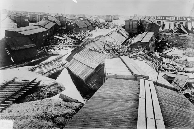
On September 8, 1900, the devastating Galveston Hurricane struck Galveston, Texas, becoming one of the deadliest natural disasters in U.S. history. The disaster...
Read More →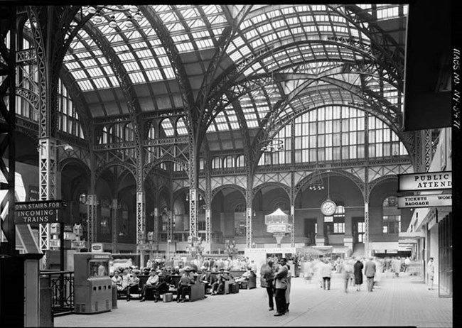
On October 19, 1923, landmark legislation for historic building preservation was enacted, creating the first comprehensive framework for protecting architectura...
Read More →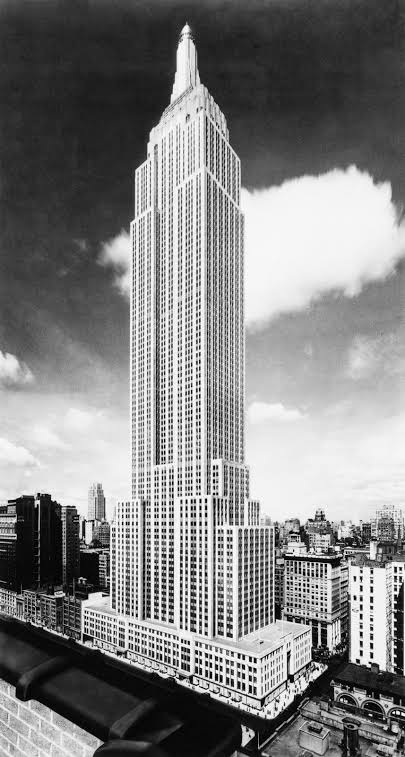
The Empire State Building, one of the tallest buildings, was completed on 19 September 1931. The Empire State Building is a 102 story, supertall skyscraper in t...
Read More →
The acquisition of land for the Model Town Society was one of the most remarkable and spirited chapters in its early history. Dewan Khem Chand and his...

Between 1921 and 1924, the land for Model Town Lahore was acquired in successive phases. The process began in 1921, shortly after the establishment of...
No comments yet. Be the first to comment!