
Syed Shayan Real Estate Archive
Syed Shayan Real Estate Archive
From Real Estate History
On This Date
At the Mediterranean entrance, a construction settlement grew into a port city whose street plan and neighbourhoods still reflect the canal’s influence.
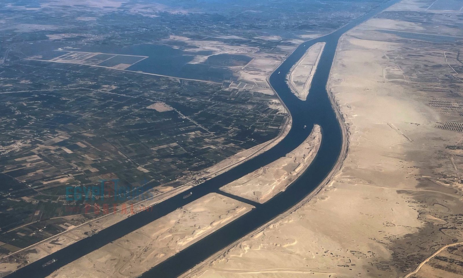
On 17 November 1869, Egypt inaugurated the Suez Canal with a procession of ships led by the French imperial yacht Laigle, carrying Empress Eugenia. The new waterway connected the Mediterranean and Red seas, giving vessels travelling between Europe and Asia a route that avoided the long voyage around southern Africa. At the canal’s northern entrance, the project had already transformed a narrow strip of land into Port Said, a growing city built to serve the waterway. The project took shape under a concession granted in 1854 to Ferdinand de Lesseps, who was authorised to establish a company to build the canal. Excavation began on 25 April 1859 at the site of what is now Port Said. Tens of thousands of workers, many of them conscripted, worked at sites across the isthmus. According to the Suez Canal Authority, crews removed about 74 million cubic metres of earth. The waters of the two seas met on 18 August 1869, three months before the formal inauguration.
Port Said stood between Lake Manzala and the Mediterranean. It began as the canal company’s northernmost worksite and drew workers, merchants and other newcomers from across Egypt and the Mediterranean. By 1869, researchers estimate that the town had about 10,000 residents. Its harbour was already receiving large shipments of coal to refuel vessels passing through the canal, giving the town an economic role that continued after excavation ended. The canal company helped shape the early street plan. In the European Quarter, a grid near the harbour and canal entrance accommodated apartment buildings with balconies and arcades. The Arab Quarter developed with smaller blocks, narrower streets and commercial areas. The two districts show how the same infrastructure project produced distinct patterns of housing and commerce within a single city.
The port’s growth also raised questions about who controlled the land beneath it. In the mid-1870s, as the Egyptian government sought recognition of its authority over land occupied by Port Said residents, occupants signed rental agreements. The episode shows how quickly a construction settlement became a city where the terms of land occupation mattered to households and businesses.
Those early development patterns still matter. Researchers studying Port Said have documented the loss of historic buildings to redevelopment, including a former school complex replaced by high-rise housing and a row of customs houses demolished for commercial construction. The losses illustrate the pressure on older properties near the canal, where waterfront land remains attractive for new development. The inauguration is remembered around the world for changing the course of maritime trade. In Port Said, its legacy can also be read in the streets around the harbour. The grid, apartment blocks and former customs buildings record the decisions that turned a construction site into a city. The redevelopment of those same sites now determines how much of that history remains visible.
▪️Syed Shayan Real Estate Archive
▪ Reference(s):
On This Date
بحیرۂ روم کی جانب نہر کے دہانے پر تعمیراتی کارکنوں کی بستی ایک بندرگاہی شہر بن گئی، جس کی سڑکوں اور محلوں میں آج بھی اس منصوبے کے اثرات نمایاں ہیں
مصر نے 17 نومبر 1869 کو نہرِ سوئز کا افتتاح بحری جہازوں کے جلوس سے کیا۔ جلوس کی قیادت فرانس کے شاہی جہاز لیگل نے کی، جس پر ملکہ یوجینی سوار تھیں۔ بحیرۂ روم اور بحیرۂ احمر کو ملانے والی اس آبی گزرگاہ کی بدولت یورپ اور ایشیا کے درمیان چلنے والے جہازوں کو افریقہ کے جنوبی سرے کا طویل چکر لگانے سے نجات ملی۔ نہر کے شمالی دہانے پر یہ منصوبہ زمین کی ایک تنگ پٹی کو پہلے ہی پورٹ سعید میں بدل چکا تھا، جو نہر کی ضروریات پوری کرنے کے لیے بسایا گیا ایک ابھرتا ہوا شہر تھا۔
منصوبے کی بنیاد 1854 میں اس وقت پڑی جب فردیناند دے لیسپس کو نہر کی تعمیر کے لیے کمپنی قائم کرنے کا اختیار دیا گیا۔ کھدائی 25 اپریل 1859 کو اس مقام سے شروع ہوئی جہاں آج پورٹ سعید واقع ہے۔ برزخِ سوئز کے مختلف مقامات پر دسیوں ہزار مزدوروں نے کام کیا، جن میں سے بہت سے جبری مشقت پر مامور تھے۔ نہرِ سوئز اتھارٹی کے مطابق کھدائی کے دوران تقریباً 7 کروڑ 40 لاکھ مکعب میٹر مٹی نکالی گئی۔ دونوں سمندروں کا پانی 18 اگست 1869 کو مل گیا، جبکہ رسمی افتتاح تین ماہ بعد ہوا۔
جھیل منزلہ اور بحیرۂ روم کے درمیان واقع پورٹ سعید ابتدا میں نہر کمپنی کا شمالی ترین تعمیراتی مرکز تھا۔ مصر اور بحیرۂ روم کے دیگر علاقوں سے مزدور، تاجر اور نئے آبادکار یہاں پہنچے۔ محققین کے اندازے کے مطابق 1869 تک شہر کی آبادی تقریباً 10 ہزار ہوچکی تھی۔ نہر سے گزرنے والے جہازوں کو ایندھن فراہم کرنے کے لیے بندرگاہ پر کوئلے کی بڑی کھیپیں پہنچنے لگی تھیں۔ اس کاروبار کی بدولت کھدائی مکمل ہونے کے بعد بھی بندرگاہ شہر کی معیشت کا اہم حصہ رہی۔
کینال کمپنی نے شہر کی ابتدائی منصوبہ بندی میں بھی کردار ادا کیا۔ یورپی محلے میں بندرگاہ اور نہر کے دہانے کے قریب سڑکیں ایک دوسرے کو قائمہ زاویوں پر کاٹتی تھیں۔ ان کے ساتھ بالکونیوں اور محرابی راہداریوں والی رہائشی عمارتیں بنائی گئیں۔ عرب محلے میں نسبتاً چھوٹے بلاک، تنگ گلیاں اور تجارتی علاقے بنے۔ ان دونوں محلوں کی ساخت سے ظاہر ہوتا ہے کہ ایک ہی تعمیراتی منصوبے کے گرد رہائش اور تجارت کے مختلف انداز کیسے پروان چڑھے۔
بندرگاہ کی ترقی کے ساتھ زمین پر اختیار کا سوال بھی سامنے آیا۔ 1870 کی دہائی کے وسط میں مصری حکومت نے پورٹ سعید کے باشندوں کے زیرِ استعمال اراضی پر اپنا اختیار تسلیم کرانے کی کوشش کی تو وہاں آباد لوگوں نے کرایے کے معاہدوں پر دستخط کیے۔ تعمیراتی بستی کے شہر میں بدلتے ہی زمین کے استعمال اور کرایے کی شرائط رہائشیوں اور کاروباری اداروں کے لیے اہم ہوگئیں۔
شہر کے تاریخی علاقوں میں نئی تعمیرات کا دباؤ آج بھی نمایاں ہے۔ پورٹ سعید پر تحقیق کرنے والے ماہرین کے مطابق ایک سابقہ سکول کمپلیکس کی جگہ بلند رہائشی عمارتیں تعمیر کی گئیں، جبکہ کسٹمز کی کئی عمارتیں تجارتی تعمیرات کے لیے گرا دی گئیں۔ نہر کنارے زمین کی تجارتی کشش نے اس علاقے کی پرانی عمارتوں پر نئی تعمیرات کا دباؤ بڑھایا ہے۔
نہرِ سوئز کا افتتاح عالمی بحری تجارت کا رخ بدلنے والے واقعے کے طور پر یاد کیا جاتا ہے۔ پورٹ سعید میں اس کی تاریخ بندرگاہ کے گرد سڑکوں کے نقشے، رہائشی عمارتوں اور کسٹمز کی سابقہ عمارتوں سے بھی جڑی ہے۔ یہ جگہیں ان فیصلوں کی نشان دہی کرتی ہیں جنہوں نے ایک تعمیراتی مرکز کو شہر میں بدل دیا۔ انہی مقامات پر نئی تعمیرات کے فیصلے طے کریں گے کہ اس تاریخ کا کتنا حصہ آنے والی نسلوں کو دکھائی دے گا۔
▪️ سید شایان ریئل اسٹیٹ آرکائیو
▪ حوالہ جات:
On 26 November 1947 the Government of West Punjab completed its first major survey of Evacuee Property, documenting thousands of abandoned agricultural lands ur...
Read More →
On 16 June 1933, U.S. President Franklin D. Roosevelt signed the National Industrial Recovery Act (NRA), one of the major laws of the New Deal era. The law was ...
Read More →
On 19 June 1913, South Africa’s Natives Land Act became law, marking one of the most consequential moments in the country’s land and property history. The legis...
Read More →
On 12 March 1613 André Le Nôtre was born in Paris France. He came from a family that had been connected with the management and care of royal gardens for severa...
Read More →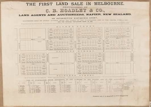
On October 10, 1885, Melbourne witnessed one of the most significant property events in its urban history when the city hosted its first large scale public land...
Read More →
The acquisition of land for the Model Town Society was one of the most remarkable and spirited chapters in its early history. Dewan Khem Chand and his...

Between 1921 and 1924, the land for Model Town Lahore was acquired in successive phases. The process began in 1921, shortly after the establishment of...
No comments yet. Be the first to comment!