
Syed Shayan Real Estate Archive
Syed Shayan Real Estate Archive
From Real Estate History
On This Date
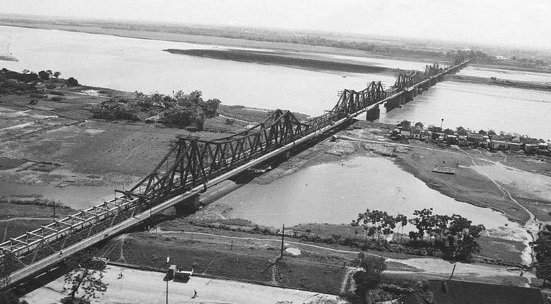
On September 13, 1889, construction officially began on a major steel bridge across the Red River in Hanoi, Vietnam. The structure later became known as Long Bien Bridge and evolved into one of the most important landmarks in the city’s urban, transport and commercial history.
The groundbreaking ceremony was held under the administration of Paul Doumer, Governor General of French Indochina. The project was intended to establish a permanent connection between Hanoi and areas on the eastern bank of the Red River, while improving access to northern Vietnam’s emerging trade and transport network. At the time, the river represented a major obstacle to the expansion of the city and the movement of people and goods.
The bridge was designed and constructed by the French engineering company Daydé & Pillé. Its main structure featured 19 steel spans supported by 20 piers. A railway track ran through the centre, while roadways and pedestrian paths were provided on both sides. The bridge’s main structure measured about 1,862 metres, making it one of the major steel bridges of its era.
Construction presented major engineering challenges because of the Red River’s changing water levels and strong currents. Deep foundations had to be built in difficult river conditions, with some foundations extending roughly 30 metres below the water level. The project was completed in 1902 and was initially named Paul Doumer Bridge after the colonial administrator who initiated the project.
Long Bien Bridge played a significant role in Hanoi’s urban development by bringing railway, road and pedestrian connectivity together across the Red River. It strengthened the city’s links with northern Vietnam and helped facilitate the movement of agricultural products, industrial goods and passengers.
The bridge later survived wars, heavy use and repeated bombing, becoming closely associated with Hanoi’s modern history. Despite its difficult past and the construction of newer bridges, Long Bien remains an important architectural and transportation landmark.
Today, Hanoi’s cultural authorities regard Long Bien Bridge as a historic witness to the capital’s development over more than a century. Its combination of engineering innovation, transport importance and architectural character has made it one of Hanoi’s most recognisable built-environment landmarks.
▪️Syed Shayan Real Estate Archive
▪ Reference(s):
On This Date
13 ستمبر 1889 کو ویتنام کے دارالحکومت ہنوئی میں دریائے سرخ پر ایک بڑے فولادی پل کی تعمیر کا باقاعدہ آغاز کیا گیا، جو بعد میں لانگ بیان پل کے نام سے مشہور ہوا۔ یہ پل صرف ایک تعمیراتی منصوبہ نہیں بلکہ ہنوئی کی شہری، تجارتی اور ٹرانسپورٹ تاریخ کا اہم سنگِ میل بن گیا۔
اس منصوبے کا سنگِ بنیاد فرانسیسی ہند چین کے گورنر جنرل پال دومر کی نگرانی میں رکھا گیا۔ مقصد ہنوئی کو دریائے سرخ کے دوسری جانب واقع علاقوں اور شمالی ویتنام کے اہم تجارتی راستوں سے بہتر طور پر جوڑنا تھا۔ اس وقت دریائے سرخ شہر کی توسیع اور نقل و حرکت کے لیے ایک بڑی رکاوٹ تھا، جبکہ ایک مستقل پل کی تعمیر سے ہنوئی کی بندرگاہوں، ریلوے اور شمالی علاقوں کے ساتھ رابطے میں نمایاں بہتری آنا تھی۔
پل کا ڈیزائن فرانسیسی انجینئرنگ کمپنی دے دے اینڈ پیلے نے تیار کیا۔ اس میں فولادی ساخت کے 19 بڑے حصے اور 20 ستون شامل تھے۔ پل کے درمیان ریلوے کے لیے راستہ جبکہ دونوں اطراف گاڑیوں اور پیدل چلنے والوں کے لیے راستے رکھے گئے تھے۔ اس کی بنیادی ساخت تقریباً 1,862 میٹر طویل تھی، جس نے اسے اپنے زمانے کے بڑے فولادی پلوں میں شامل کر دیا۔
تعمیر کے دوران دریائے سرخ کے بلند و پست پانی اور تیز بہاؤ نے انجینئرز کے لیے بڑے چیلنجز پیدا کیے۔ پل کی بنیادیں دریا کی سطح سے تقریباً 30 میٹر تک گہرائی میں تیار کی گئیں۔ منصوبہ بالآخر 1902 میں مکمل ہوا اور ابتدا میں اسے پال دومر کے نام سے منسوب کیا گیا۔
لانگ بیان پل نے ہنوئی کی شہری ترقی پر گہرا اثر ڈالا۔ یہ پل ریلوے، سڑک اور پیدل آمدورفت کو ایک ہی راستے میں جوڑنے والا اہم بنیادی ڈھانچہ بن گیا اور شہر کو شمالی ویتنام کے وسیع تر تجارتی و صنعتی نیٹ ورک سے منسلک کرنے میں مدد دی۔
وقت کے ساتھ یہ پل جنگوں، بمباری اور شدید استعمال کے باوجود ہنوئی کی شناخت کا حصہ بنا رہا۔ آج لانگ بیان پل کو ہنوئی کی تاریخ، تعمیراتی ورثے اور شہری ارتقا کی ایک اہم علامت سمجھا جاتا ہے۔ ہنوئی کے سرکاری ثقافتی ادارے اسے شہر کی تاریخ کا ایک اہم ’’تاریخی گواہ‘‘ قرار دیتے ہیں۔
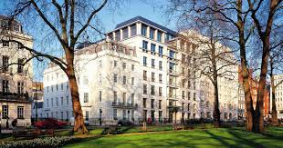
On 3 July 1919, Helical Bar and Engineering Company Limited was incorporated in London. The company was originally established to manufacture and sell reinforci...
Read More →On 26 November 1947 the Government of West Punjab completed its first major survey of Evacuee Property, documenting thousands of abandoned agricultural lands ur...
Read More →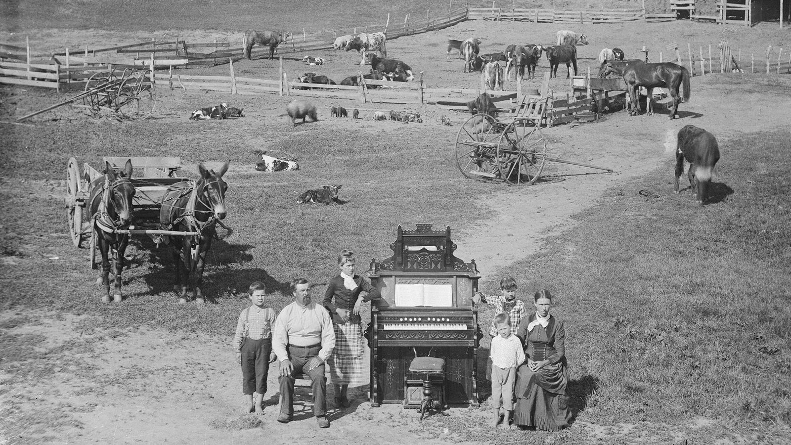
On 1 January 1863, a landmark piece of legislation came into force in the United States known as the Homestead Act. For the first time, the law granted ordinary...
Read More →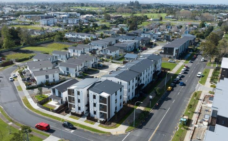
New Zealand’s Urban Development Act 2020 came into force, introducing a new legal framework for undertaking complex housing and city development projects across...
Read More →
On October 28, 2020, Pakistan implemented a comprehensive COVID-19 recovery package specifically targeting the construction sector to stimulate economic revival...
Read More →
The acquisition of land for the Model Town Society was one of the most remarkable and spirited chapters in its early history. Dewan Khem Chand and his...

Between 1921 and 1924, the land for Model Town Lahore was acquired in successive phases. The process began in 1921, shortly after the establishment of...
No comments yet. Be the first to comment!